
One of the most steep and challenging walks in Wellington Park, with a long section of rock scrambling toward the end, which is rewarded by the impressive views and the epic dolerite landscape of the Lost World.
Highlights
Rock scrambling, panoramic views and the epic dolerite landscape of the Lost World. Keep your eyes out for Yellow-tailed Black Cockatoos (Zanda funereal) and Wedge-tailed Eagles (Aquila audax fleayi).
Nature
Park size: 18,011 hectares
Natural features
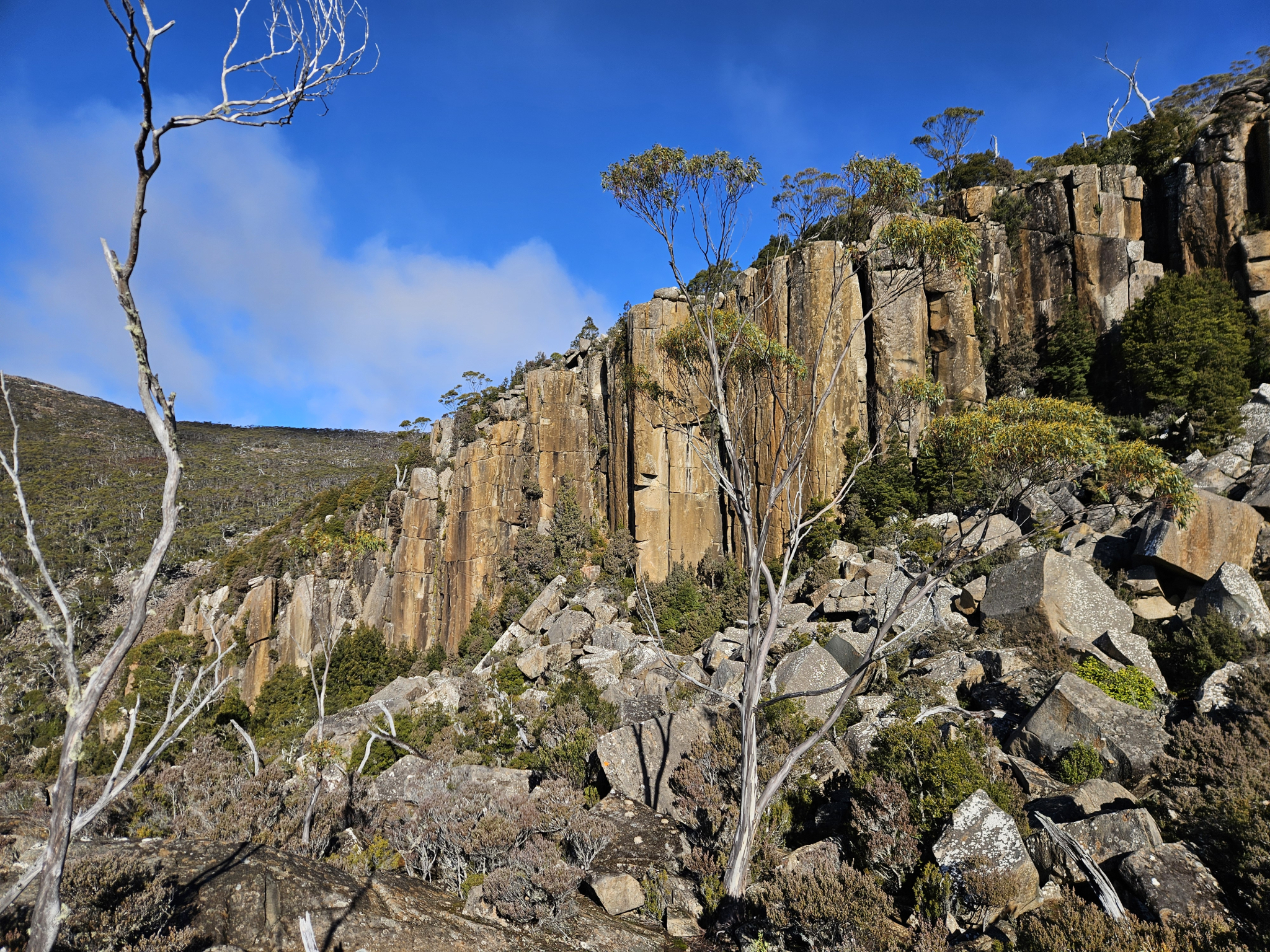
The rugged cliffs and dolerite slabs of the Lost World, Eucalyptus forest, Yellow-tailed Black Cockatoos (Zanda funereal), Wedge-tailed Eagle (Aquila audax fleayi), several species of mountain berry and other subalpine species.
Conservation
Kunanyi/Mt Wellington is a known breeding ground for the critically endangered Swift Parrot (Lathamus discolor) and is also home to the endangered Tasmanian Masked Owl (Tyto novaehollandiae castanops), Wedge-tailed Eagle (Aquila audax fleayi) and Tasmanian Devil (Sarcophilus harrisii).
Feral cats are a threat to biodiversity within the park, as are other Introduced species including the Superb Lyrebird (Menura novaehollandiae).
Track details
The trail starts at the end of Lenah Valley Road, where there is a concrete walkway across the New Town Rivulet. Cross the rivulet and pass a white gate. Continue walking for around 200 metres before coming to a Y intersection. Take the right trail which is the Lenah Valley Fire Trail. Follow the trail through the dry eucalyptus forest for around 550 metres, after which you will reach a signposted intersection.
Here, you leave the fire trail behind and continue on to the Old Hobartians Track, which begins with a steep incline up stone steps with a handrail. The trail is quite steep in sections. This section of the trail traverses through denser forest, with the New Town Rivulet flowing at the bottom of the valley.
After walking up hill for around 600 metres you will reach another signposted intersection. Here, there is the ruins of an old hut, one of several that were built throughout the mountain in the late 19th and early 20th century by local Hobartians.
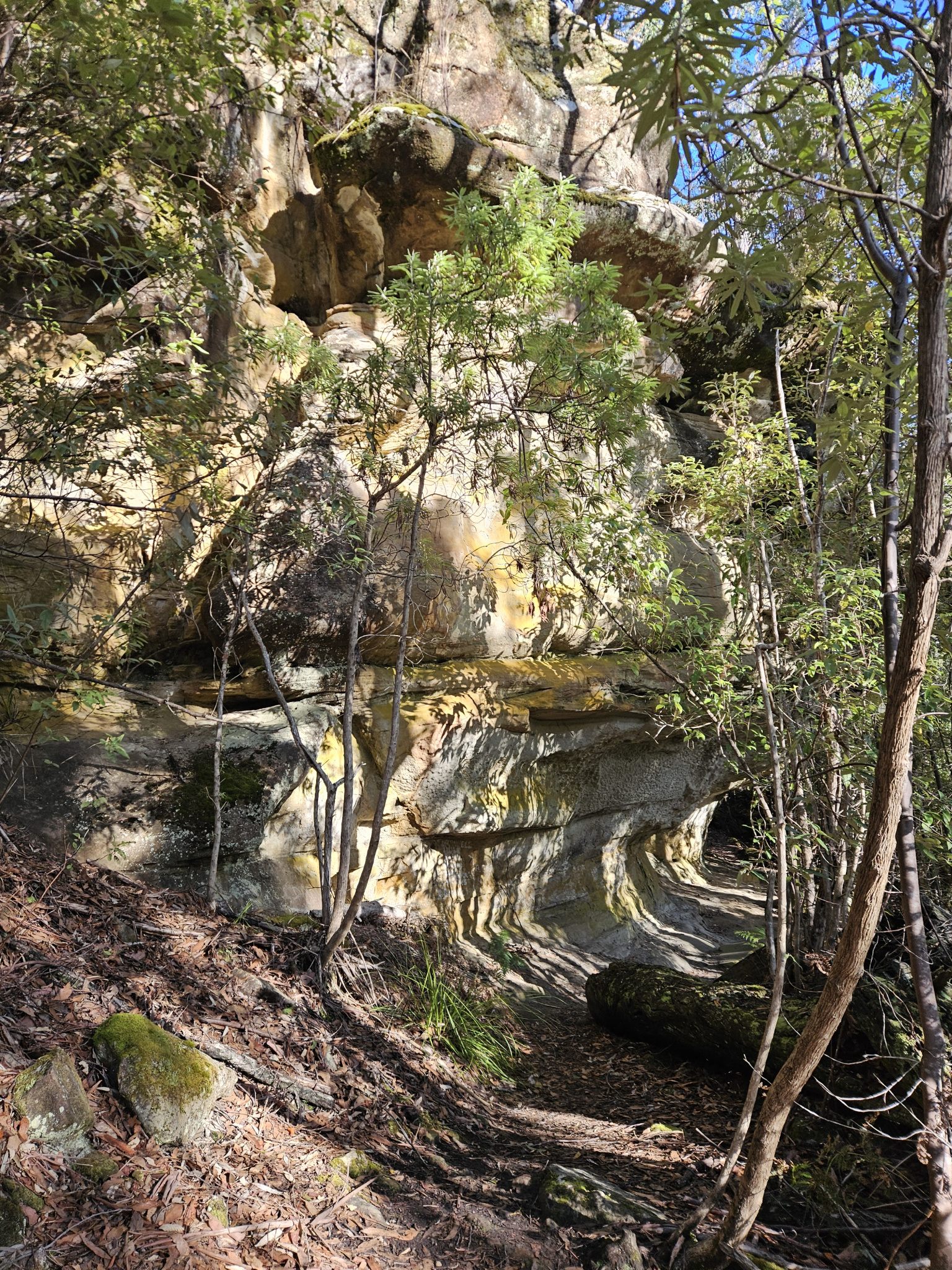
Continue walking straight at this intersection, following the sign post for the Old Hobartian Track to the Lost World. The trail climbs steadily upwards, and once you are around 2.22km you will come to a large, overhanging sandstone outcrop, which makes a good spot to stop for a drink and a snack.
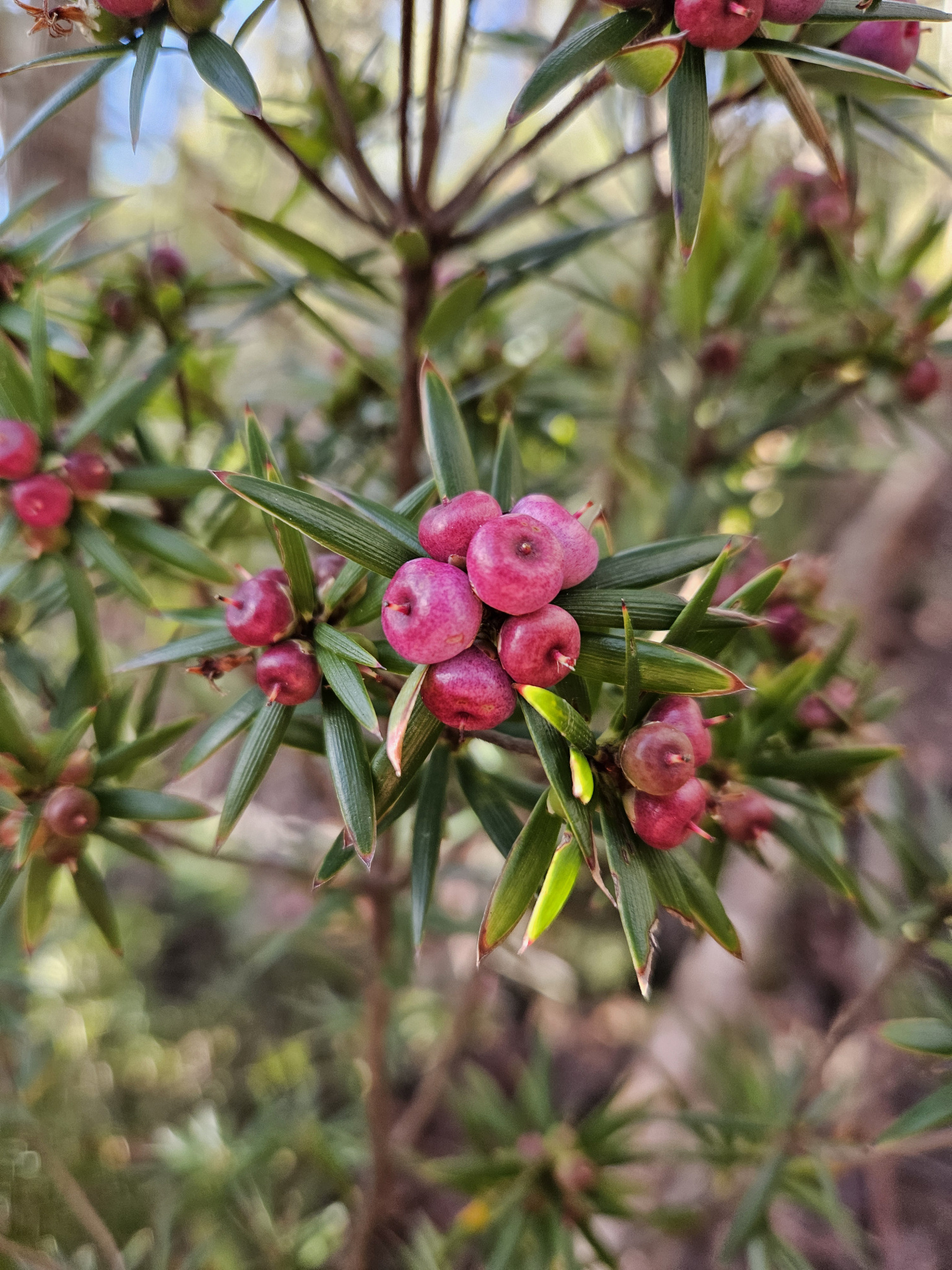
As you make your way upward increasing in altitude, the flora around you will gradually change, with montane flora beginning to blend in with the eucalyptus forest along the trail, such as the Mountain pinkberry (Leptecophylla parvifolia) and the Mountain snowberry (Gaultheria hispida).
Once you have travelled around 3.3km, you should get a few glimpses of the Lost World above you off to the right, and shortly after you will come to a creek crossing. It is generally easy to cross and is quite picturesque. If there has been heavy rain and the creek is in flood, however, you should only cross if safe to do so, but this is generally not an issue.
A little further up the hill at around 3.47km into the walk, you will come to a track intersection. By this stage you will likely have been walking for 1.5-2 hours, and while there is not a large distance to cover to the Lost World, there is still significant altitude to gain.
Take the right-hand turn. Shortly after the intersection, you will come to a large, mostly dry riverbed. Once again, if the river is in flood, do not attempt to cross. This, however, would only be the case after very heavy rainfall.
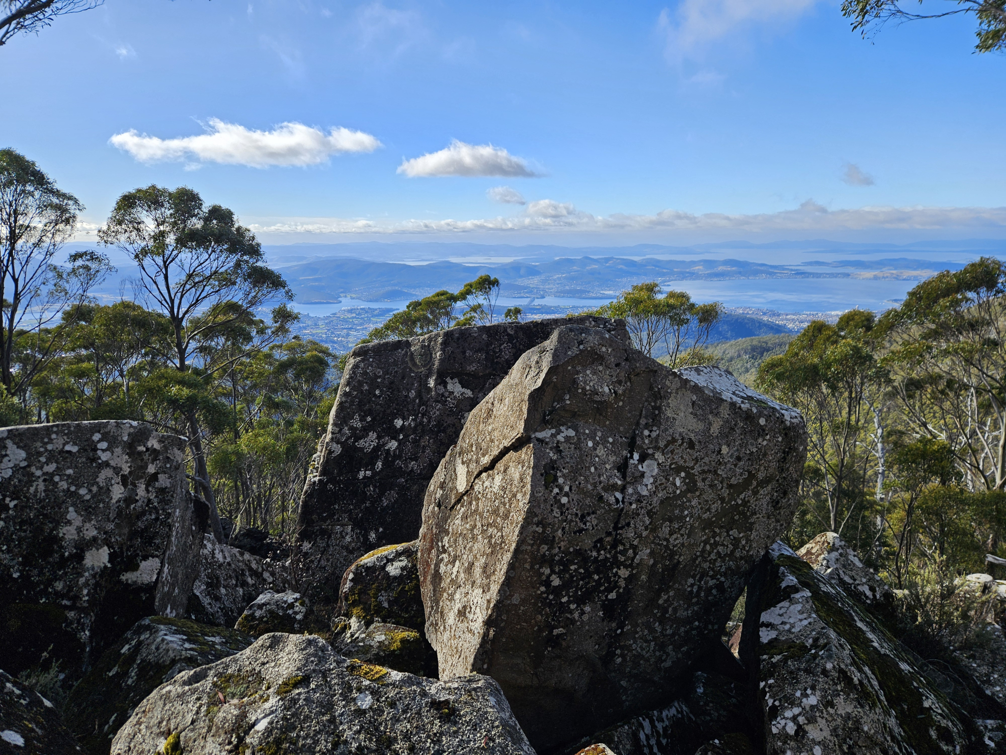
Cross the riverbed and the trail starts again. Soon after this is where the rock scrambling begins, with the track going steeply upwards on large, Dolerite boulders covered in lichen and Moss.
This section can often be slippery, especially in the cooler months. Be sure to keep an eye out for orange triangle markers and painted circles on the rocks for the direction, as there are several spots on this section of the trail where it can be unclear which direction to travel in.
If you are ever unsure if you are going the right way, stop, have a look around you, and if you can’t see any direction markers or if where you are heading doesn’t look safe to cross, you may want to backtrack to the last marker and reconsider your path.
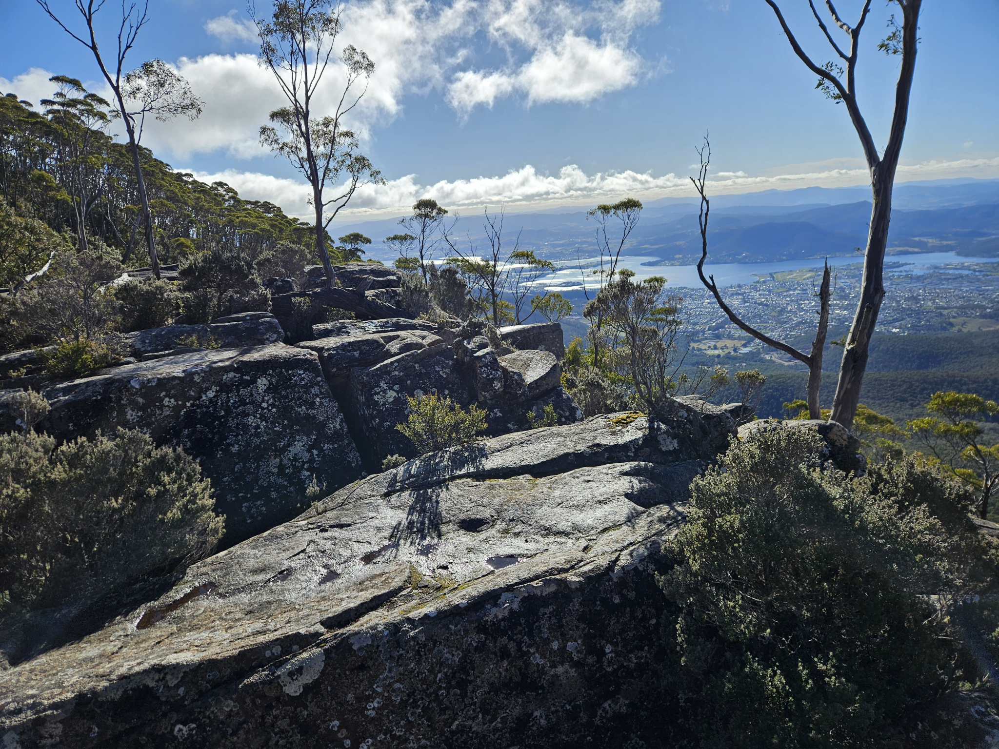
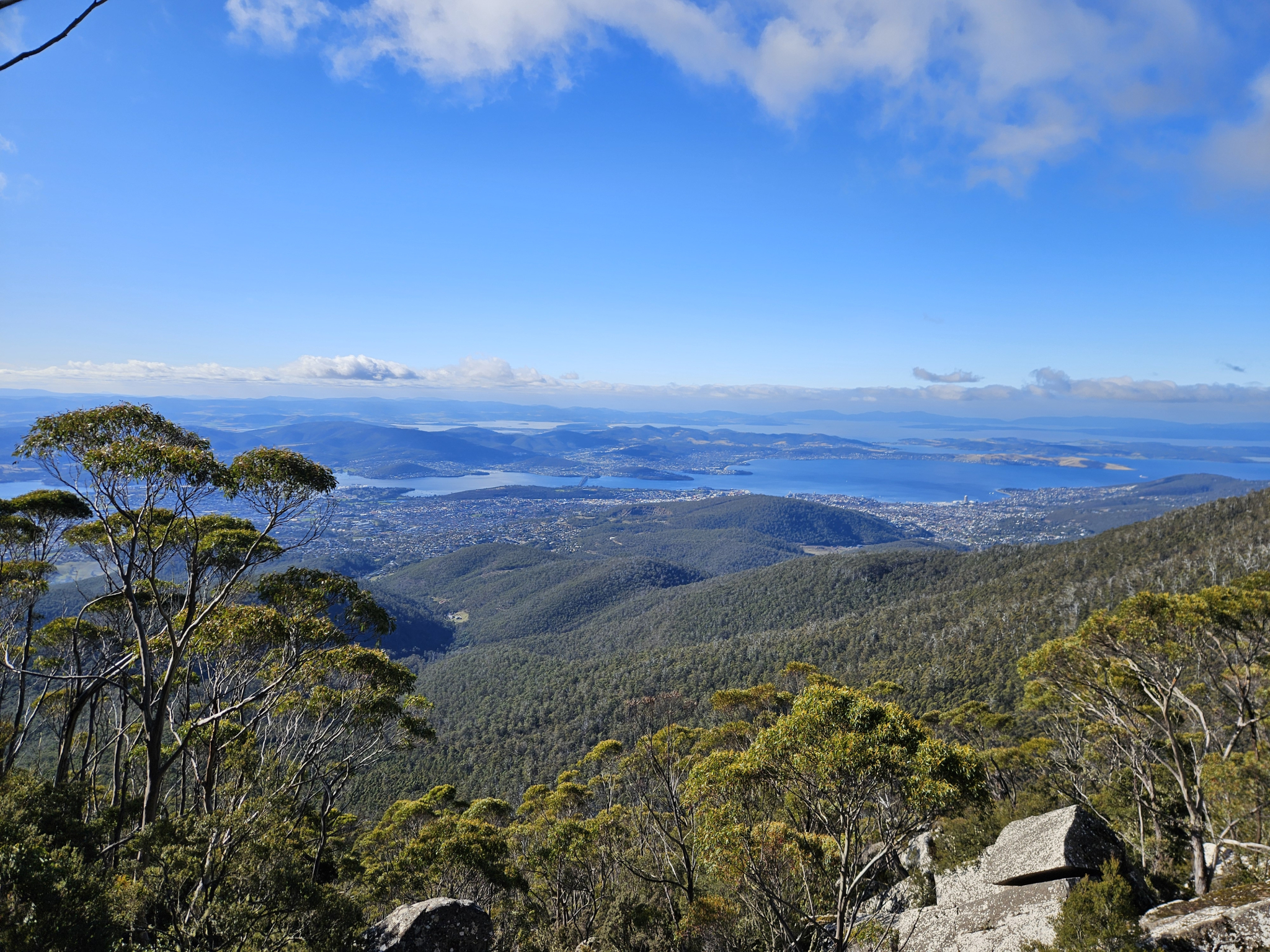
There are several locations along this section where you will get excellent views looking back of Hobart and its surrounds, so be sure to take a break and enjoy the views on your way up.
Just before you reach the Lost World, you will reach a section of very steep rock scrambling, before coming out onto the rock slabs of the Lost World.
At the back of this area are the large cliffs that are visible from Hobart, and there are multiple large rock slabs that make a great spot to sit, enjoy the view (weather permitting) and have some lunch. As you explore the area, be careful when crossing between rock slabs, as there are several large crevasses that should be avoided.
Once you are ready to continue, you have the option to either head back the way you came, or continue walking for a longer but far less technical descent. If you choose to take the circuit route, please refer to “The Old Hobartian and Hunter Track Circuit” trail notes for further directions.
History
Name history
The Old Hobartian Track was named after the Old Hobartian Association, who raised the funds to construct the trail between 1932 and 1934.
Conditions
This is a very steep walk, with long sections of steep rock scrambling, which becomes more dangerous when wet or frozen. As such, it is not an appropriate walk to complete when there is bad weather or heavy snow.
Weather conditions within Wellington Park can change rapidly, potentially bringing high winds, rain, and snow, even in summer. Check local weather forecasts before attempting any walks in Wellington Park.
Ensure you have appropriate sun protection, as UV radiation is stronger in high altitude areas, such as on mountains. The fire danger rating for the area should also be checked. Be aware that Wellington Park is closed on days with a fire danger rating of Extreme or Catastrophic in the Upper Derwent Valley or South East districts.
For up to date weather forecasting on Kunanyi/Mount Wellington, refer to: http://www.bom.gov.au/tas/forecasts/mtwellington.shtml
Safety advice
There are exposed cliff faces at the Lost World, as well as at several other locations throughout the walk, where extra care should be taken.
There is around 40 minutes of steep rock scrambling for the last section up to the Lost World. As such, this trail is not recommended during bad weather or after heavy snow fall, and extra caution should be taken when rocks are slippery from rain or ice.
Weather can change rapidly in the region, especially in the top section of the walk around the Lost World, which is fully exposed to the mountain conditions.
Ensure you have a map of the area and pay attention to which direction you are going, especially during the rock scrambling section.
Ensure you are appropriately prepared for mountain weather conditions, and have warm clothing, a waterproof jacket, sturdy walking shoes or boots, and enough food and water. Be aware that conditions can change rapidly in the area.
Ensure you have informed two other people of the walk you intend to do in case of emergency.
Hikers should also be aware of the possibility of bushfires as this is a forested environment.
During spring, summer and autumn, be aware that snakes may be active in the area. If encountered, move away from them slowly.
If you are injured and require emergency medical attention, call 000.
For further information on bushfires in Tasmania, refer to: https://www.fire.tas.gov.au/
Age restrictions and advice
This walk is not recommended for children below the age of 12, and adult supervision is recommended at all times due to exposed cliff faces and crevasses.
Location
387a Lenah Valley Road, Lenah Valley Tasmania 7008, Australia
From Hobart, drive north up Elizabeth Street for around 2km before turning on to Augusta Road. Follow Augusta Road until it becomes Lenah valley Road for 5.3km. This will bring you to the end of road, stopping where there is a small car park before it becomes private access only.
Nature
Park size: 18,011 hectares
Natural features
The rugged cliffs and dolerite slabs of the Lost World, Eucalyptus forest, Yellow-tailed Black Cockatoos (Zanda funereal), Wedge-tailed Eagle (Aquila audax fleayi), several species of mountain berry and other subalpine species.
Conservation
Kunanyi/Mt Wellington is a known breeding ground for the critically endangered Swift Parrot (Lathamus discolor) and is also home to the endangered Tasmanian Masked Owl (Tyto novaehollandiae castanops), Wedge-tailed Eagle (Aquila audax fleayi) and Tasmanian Devil (Sarcophilus harrisii).
Feral cats are a threat to biodiversity within the park, as are other Introduced species including the Superb Lyrebird (Menura novaehollandiae).
Track details
The trail starts at the end of Lenah Valley Road, where there is a concrete walkway across the New Town Rivulet. Cross the rivulet and pass a white gate. Continue walking for around 200 metres before coming to a Y intersection. Take the right trail which is the Lenah Valley Fire Trail. Follow the trail through the dry eucalyptus forest for around 550 metres, after which you will reach a signposted intersection.
Here, you leave the fire trail behind and continue on to the Old Hobartians Track, which begins with a steep incline up stone steps with a handrail. The trail is quite steep in sections. This section of the trail traverses through denser forest, with the New Town Rivulet flowing at the bottom of the valley.
After walking up hill for around 600 metres you will reach another signposted intersection. Here, there is the ruins of an old hut, one of several that were built throughout the mountain in the late 19th and early 20th century by local Hobartians.
Continue walking straight at this intersection, following the sign post for the Old Hobartian Track to the Lost World. The trail climbs steadily upwards, and once you are around 2.22km you will come to a large, overhanging sandstone outcrop, which makes a good spot to stop for a drink and a snack.
As you make your way upward increasing in altitude, the flora around you will gradually change, with montane flora beginning to blend in with the eucalyptus forest along the trail, such as the Mountain pinkberry (Leptecophylla parvifolia) and the Mountain snowberry (Gaultheria hispida).
Once you have travelled around 3.3km, you should get a few glimpses of the Lost World above you off to the right, and shortly after you will come to a creek crossing. It is generally easy to cross and is quite picturesque. If there has been heavy rain and the creek is in flood, however, you should only cross if safe to do so, but this is generally not an issue.
A little further up the hill at around 3.47km into the walk, you will come to a track intersection. By this stage you will likely have been walking for 1.5-2 hours, and while there is not a large distance to cover to the Lost World, there is still significant altitude to gain.
Take the right-hand turn. Shortly after the intersection, you will come to a large, mostly dry riverbed. Once again, if the river is in flood, do not attempt to cross. This, however, would only be the case after very heavy rainfall.
Cross the riverbed and the trail starts again. Soon after this is where the rock scrambling begins, with the track going steeply upwards on large, Dolerite boulders covered in lichen and Moss.
This section can often be slippery, especially in the cooler months. Be sure to keep an eye out for orange triangle markers and painted circles on the rocks for the direction, as there are several spots on this section of the trail where it can be unclear which direction to travel in.
If you are ever unsure if you are going the right way, stop, have a look around you, and if you can’t see any direction markers or if where you are heading doesn’t look safe to cross, you may want to backtrack to the last marker and reconsider your path.
There are several locations along this section where you will get excellent views looking back of Hobart and its surrounds, so be sure to take a break and enjoy the views on your way up.
Just before you reach the Lost World, you will reach a section of very steep rock scrambling, before coming out onto the rock slabs of the Lost World.
At the back of this area are the large cliffs that are visible from Hobart, and there are multiple large rock slabs that make a great spot to sit, enjoy the view (weather permitting) and have some lunch. As you explore the area, be careful when crossing between rock slabs, as there are several large crevasses that should be avoided.
Once you are ready to continue, you have the option to either head back the way you came, or continue walking for a longer but far less technical descent. If you choose to take the circuit route, please refer to “The Old Hobartian and Hunter Track Circuit” trail notes for further directions.
History
Name history
The Old Hobartian Track was named after the Old Hobartian Association, who raised the funds to construct the trail between 1932 and 1934.
Conditions
This is a very steep walk, with long sections of steep rock scrambling, which becomes more dangerous when wet or frozen. As such, it is not an appropriate walk to complete when there is bad weather or heavy snow.
Weather conditions within Wellington Park can change rapidly, potentially bringing high winds, rain, and snow, even in summer. Check local weather forecasts before attempting any walks in Wellington Park.
Ensure you have appropriate sun protection, as UV radiation is stronger in high altitude areas, such as on mountains. The fire danger rating for the area should also be checked. Be aware that Wellington Park is closed on days with a fire danger rating of Extreme or Catastrophic in the Upper Derwent Valley or South East districts.
For up to date weather forecasting on Kunanyi/Mount Wellington, refer to: http://www.bom.gov.au/tas/forecasts/mtwellington.shtml
Safety advice
There are exposed cliff faces at the Lost World, as well as at several other locations throughout the walk, where extra care should be taken.
There is around 40 minutes of steep rock scrambling for the last section up to the Lost World. As such, this trail is not recommended during bad weather or after heavy snow fall, and extra caution should be taken when rocks are slippery from rain or ice.
Weather can change rapidly in the region, especially in the top section of the walk around the Lost World, which is fully exposed to the mountain conditions.
Ensure you have a map of the area and pay attention to which direction you are going, especially during the rock scrambling section.
Ensure you are appropriately prepared for mountain weather conditions, and have warm clothing, a waterproof jacket, sturdy walking shoes or boots, and enough food and water. Be aware that conditions can change rapidly in the area.
Ensure you have informed two other people of the walk you intend to do in case of emergency.
Hikers should also be aware of the possibility of bushfires as this is a forested environment.
During spring, summer and autumn, be aware that snakes may be active in the area. If encountered, move away from them slowly.
If you are injured and require emergency medical attention, call 000.
For further information on bushfires in Tasmania, refer to: https://www.fire.tas.gov.au/
Age restrictions and advice
This walk is not recommended for children below the age of 12, and adult supervision is recommended at all times due to exposed cliff faces and crevasses.
Location
387a Lenah Valley Road, Lenah Valley Tasmania 7008, Australia
From Hobart, drive north up Elizabeth Street for around 2km before turning on to Augusta Road. Follow Augusta Road until it becomes Lenah valley Road for 5.3km. This will bring you to the end of road, stopping where there is a small car park before it becomes private access only.