
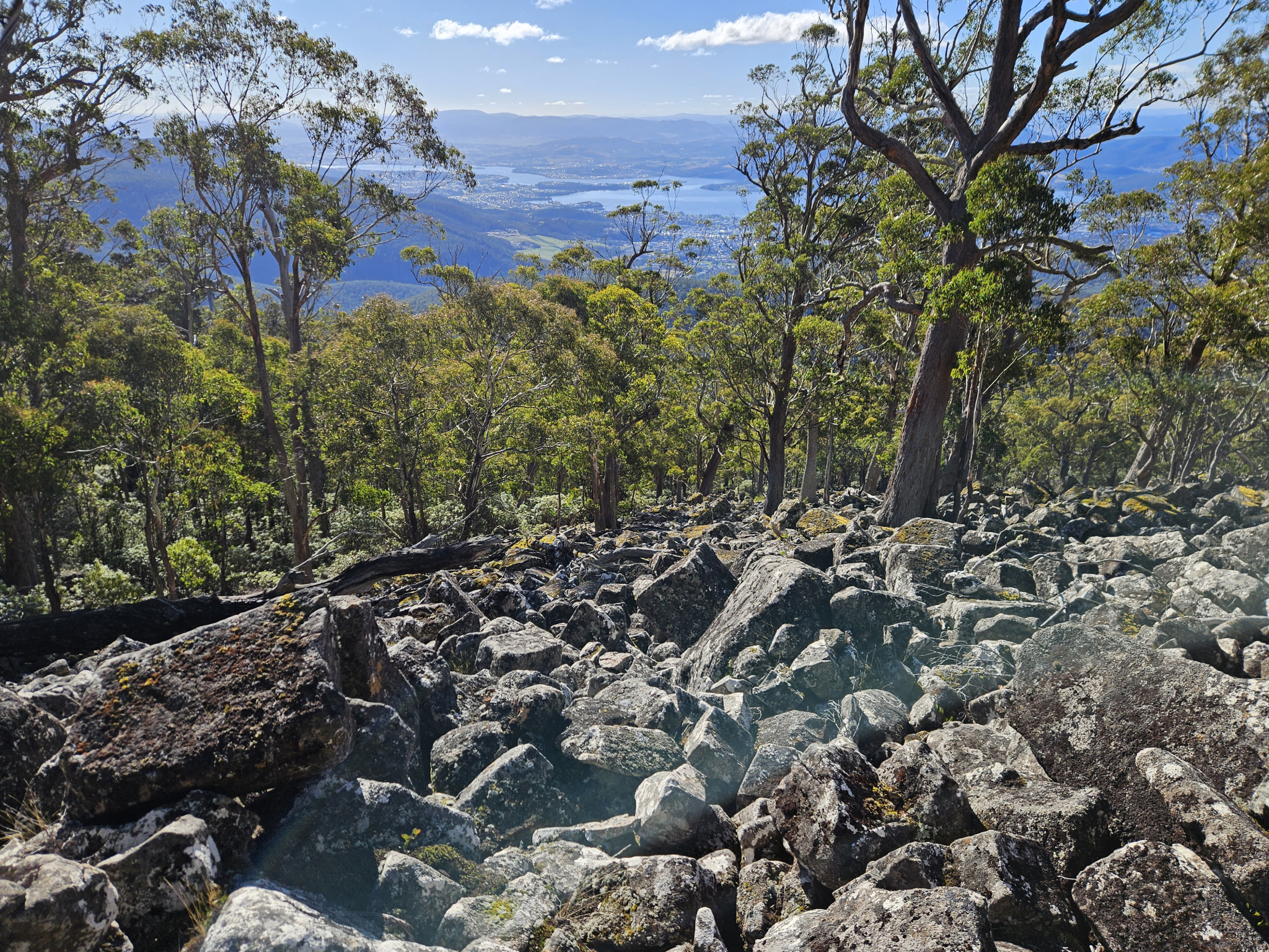
A well-maintained connecting trail through eucalyptus forest, including scree slopes and excellent views of The Derwent River. After walking other trails like the Myrtle Gully Track or Lenah Valley Track to Junction Cabin, this trail can be used to access the higher reaches of the mountain.
Highlights
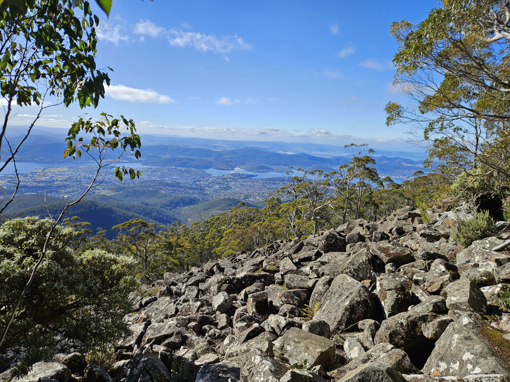
Scree slopes, excellent views and open eucalyptus forest.
Nature
Park size: 18,011 hectares
Natural features
Eucalyptus forest and woodlands, Silver banksia (Banksia marginata), the sandstone outcrop at Crocodile Rock, dolerite boulder fields and plentiful birdlife.
Conservation
Kunanyi/Mt Wellington is a known breeding ground for the critically endangered Swift Parrot (Lathamus discolor) and is also home to the endangered Tasmanian Masked Owl (Tyto novaehollandiae castanops), Wedge-tailed Eagle (Aquila audax fleayi) and Tasmanian Devil (Sarcophilus harrisii).
Feral cats are a threat to biodiversity within the park, as are other Introduced species including the Superb Lyrebird (Menura novaehollandiae).
Track details
This trail can be either accessed as a connecting trail from Junction Cabin after using another track for access such as The Myrtle Gully Track, or can be used to go down the mountain from the Pinnacle Road access point near The Chalet. While this guide provides directions from Junction Cabin, it is a one way track and can be started from either end depending on where you want to end up.
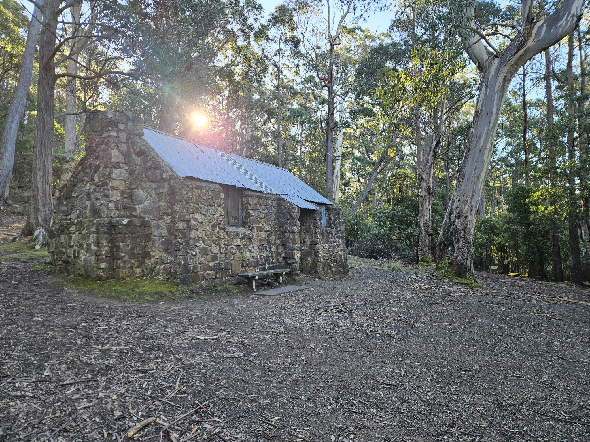
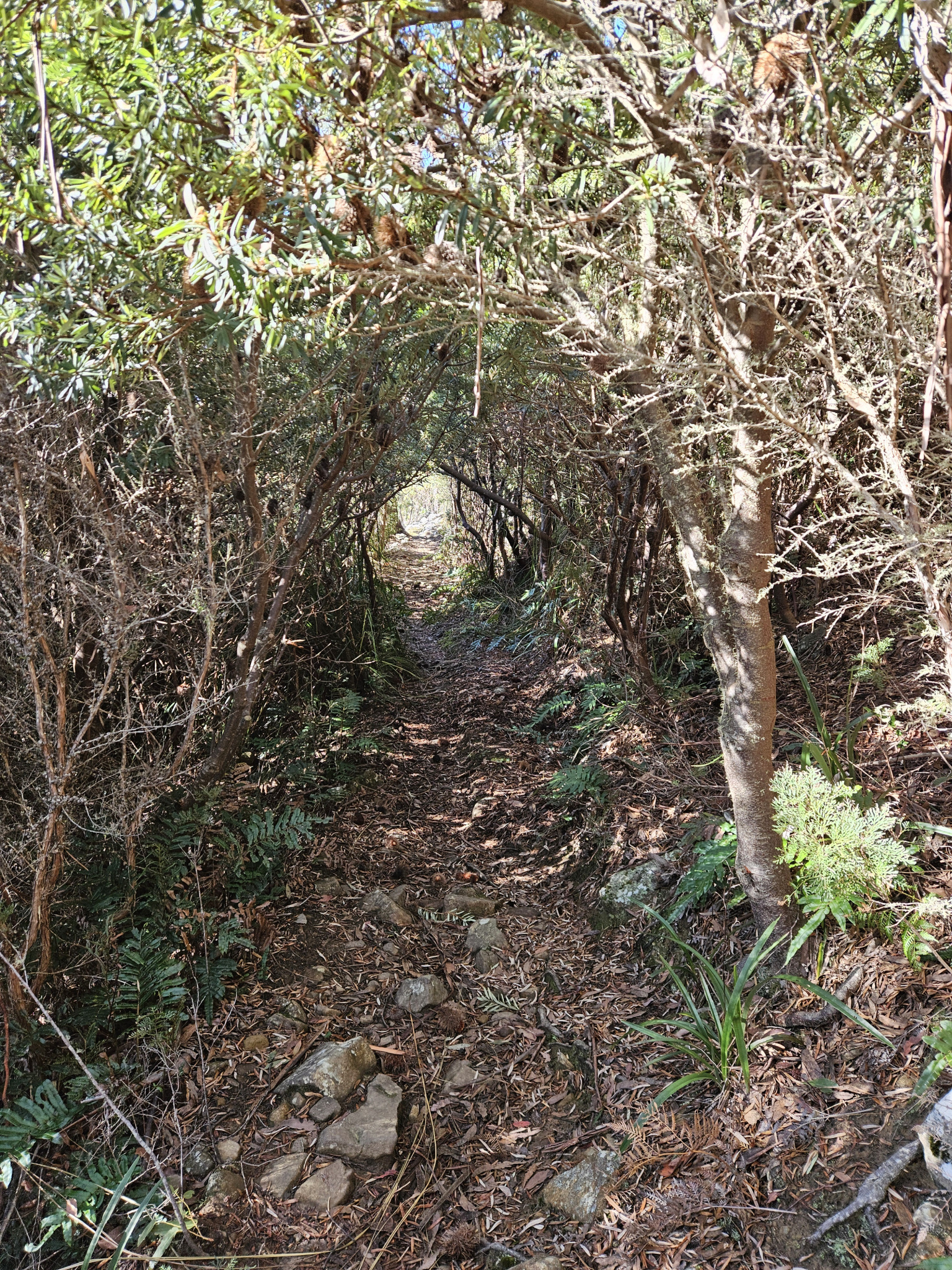
The Hunters Track starts at the top side of the Junction Cabin Clearing, and there is a sign post directing you onto the correct track. From here, begin making your way up hill. Gradually, the forest will open up into an open eucalyptus woodland, and after walking around 500 metres you will see a sign for Crocodile Rock, which is an outcrop of triassic sandstone which is sometimes frequented by rock climbers.
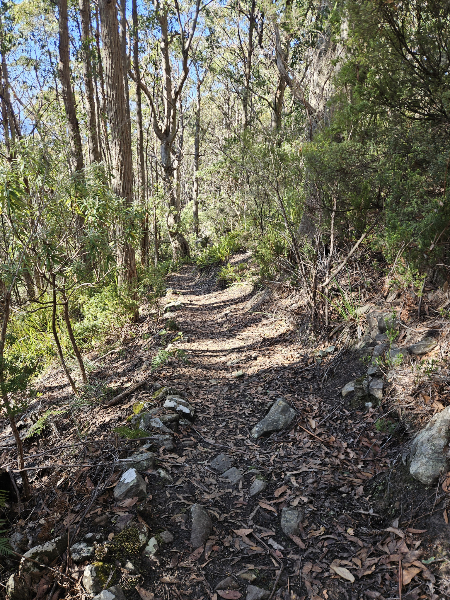
Continue along the trail and you will come across the first of several scree slopes. Generally, the trail remains easy to follow when crossing, however, if there has been recent snow falling take care and follow the orange arrows across. Some excellent views can be had from the scree slopes, as the forest is clearer in this sections.
After walking around 1.5km you will reach an intersection. Take the left hand turn continuing up the hill. After around 350 metres, you will reach Pinnacle Road and the end of The Hunters Track.
From here, you have the option of returning the way you came, or continuing further up the mountain using one of the nearby trails such as The Organ Pipes Track, which starts around 100 metres to the right, uphill from The Hunters Track.
Conditions
Weather conditions within Wellington Park can change rapidly, potentially bringing high winds, rain, and snow, even in summer. Check local weather forecasts before attempting any walks in Wellington Park.
Ensure you have appropriate sun protection, as UV radiation is stronger in high altitude areas, such as on mountains. The fire danger rating for the area should also be checked. Be aware that Wellington Park is closed on days with a fire danger rating of Extreme or Catastrophic in the Upper Derwent Valley or South East districts.
For up to date weather forecasting on Kunanyi/Mount Wellington, refer to: http://www.bom.gov.au/tas/forecasts/mtwellington.shtml
Safety advice
Ensure you are appropriately prepared for mountain weather conditions, and have warm clothing, a waterproof jacket, sturdy walking shoes or boots, and enough food and water. Ensure you have a map of the area, and be aware that conditions can change rapidly in the area.
After heavy snow, the trail may vanish in sections that traverse rocky scree slopes.
Hikers should also be aware of the possibility of bushfires as this is a forested environment.
During spring, summer and autumn, be aware that snakes may be active in the area. If encountered, move away from them slowly.
If you are injured and require emergency medical attention, call 000.
For further information on bushfires in Tasmania, refer to: https://www.fire.tas.gov.au/
Age restrictions and advice
While this is a well maintained trail, it is quite steep and it is generally not suitable for very young children. Be aware that the trail finishes at a road, where children should be supervised at all times.
Location
Lenah Valley Fire Trail, Wellington Park Tasmania 7054, Australia
The Hunters Track is a connecting trail that begins at the top side of Junction Cabin. To access this trail, please refer to other walks that lead to Junction Cabin, such as The Myrtle Gully Track, or The Lenah Valley Track. The bottom of this trail is not accessible by car.
Alternatively, you can catch the Mountain Explorer bus to the top of The Hunters Track, getting off at The Chalet bus stop on Pinnacle Road which is around 100 metres uphill from the track, and make your way down the trail instead.
Nature
Park size: 18,011 hectares
Natural features
Eucalyptus forest and woodlands, Silver banksia (Banksia marginata), the sandstone outcrop at Crocodile Rock, dolerite boulder fields and plentiful birdlife.
Conservation
Kunanyi/Mt Wellington is a known breeding ground for the critically endangered Swift Parrot (Lathamus discolor) and is also home to the endangered Tasmanian Masked Owl (Tyto novaehollandiae castanops), Wedge-tailed Eagle (Aquila audax fleayi) and Tasmanian Devil (Sarcophilus harrisii).
Feral cats are a threat to biodiversity within the park, as are other Introduced species including the Superb Lyrebird (Menura novaehollandiae).
Track details
This trail can be either accessed as a connecting trail from Junction Cabin after using another track for access such as The Myrtle Gully Track, or can be used to go down the mountain from the Pinnacle Road access point near The Chalet. While this guide provides directions from Junction Cabin, it is a one way track and can be started from either end depending on where you want to end up.
The Hunters Track starts at the top side of the Junction Cabin Clearing, and there is a sign post directing you onto the correct track. From here, begin making your way up hill. Gradually, the forest will open up into an open eucalyptus woodland, and after walking around 500 metres you will see a sign for Crocodile Rock, which is an outcrop of triassic sandstone which is sometimes frequented by rock climbers.
Continue along the trail and you will come across the first of several scree slopes. Generally, the trail remains easy to follow when crossing, however, if there has been recent snow falling take care and follow the orange arrows across. Some excellent views can be had from the scree slopes, as the forest is clearer in this sections.
After walking around 1.5km you will reach an intersection. Take the left hand turn continuing up the hill. After around 350 metres, you will reach Pinnacle Road and the end of The Hunters Track.
From here, you have the option of returning the way you came, or continuing further up the mountain using one of the nearby trails such as The Organ Pipes Track, which starts around 100 metres to the right, uphill from The Hunters Track.
Conditions
Weather conditions within Wellington Park can change rapidly, potentially bringing high winds, rain, and snow, even in summer. Check local weather forecasts before attempting any walks in Wellington Park.
Ensure you have appropriate sun protection, as UV radiation is stronger in high altitude areas, such as on mountains. The fire danger rating for the area should also be checked. Be aware that Wellington Park is closed on days with a fire danger rating of Extreme or Catastrophic in the Upper Derwent Valley or South East districts.
For up to date weather forecasting on Kunanyi/Mount Wellington, refer to: http://www.bom.gov.au/tas/forecasts/mtwellington.shtml
Safety advice
Ensure you are appropriately prepared for mountain weather conditions, and have warm clothing, a waterproof jacket, sturdy walking shoes or boots, and enough food and water. Ensure you have a map of the area, and be aware that conditions can change rapidly in the area.
After heavy snow, the trail may vanish in sections that traverse rocky scree slopes.
Hikers should also be aware of the possibility of bushfires as this is a forested environment.
During spring, summer and autumn, be aware that snakes may be active in the area. If encountered, move away from them slowly.
If you are injured and require emergency medical attention, call 000.
For further information on bushfires in Tasmania, refer to: https://www.fire.tas.gov.au/
Age restrictions and advice
While this is a well maintained trail, it is quite steep and it is generally not suitable for very young children. Be aware that the trail finishes at a road, where children should be supervised at all times.
Location
Lenah Valley Fire Trail, Wellington Park Tasmania 7054, Australia
The Hunters Track is a connecting trail that begins at the top side of Junction Cabin. To access this trail, please refer to other walks that lead to Junction Cabin, such as The Myrtle Gully Track, or The Lenah Valley Track. The bottom of this trail is not accessible by car.
Alternatively, you can catch the Mountain Explorer bus to the top of The Hunters Track, getting off at The Chalet bus stop on Pinnacle Road which is around 100 metres uphill from the track, and make your way down the trail instead.
Key info
50 minutes one way
1.8km one way
Grade 3: Difficult
There are no facilities on this trail. While dogs are allowed on this trail, they must remain on a leash at all times to protect native species in the area. Be aware that dogs are not allowed on tracks higher up the mountain such as The Organ Pipes Track.