
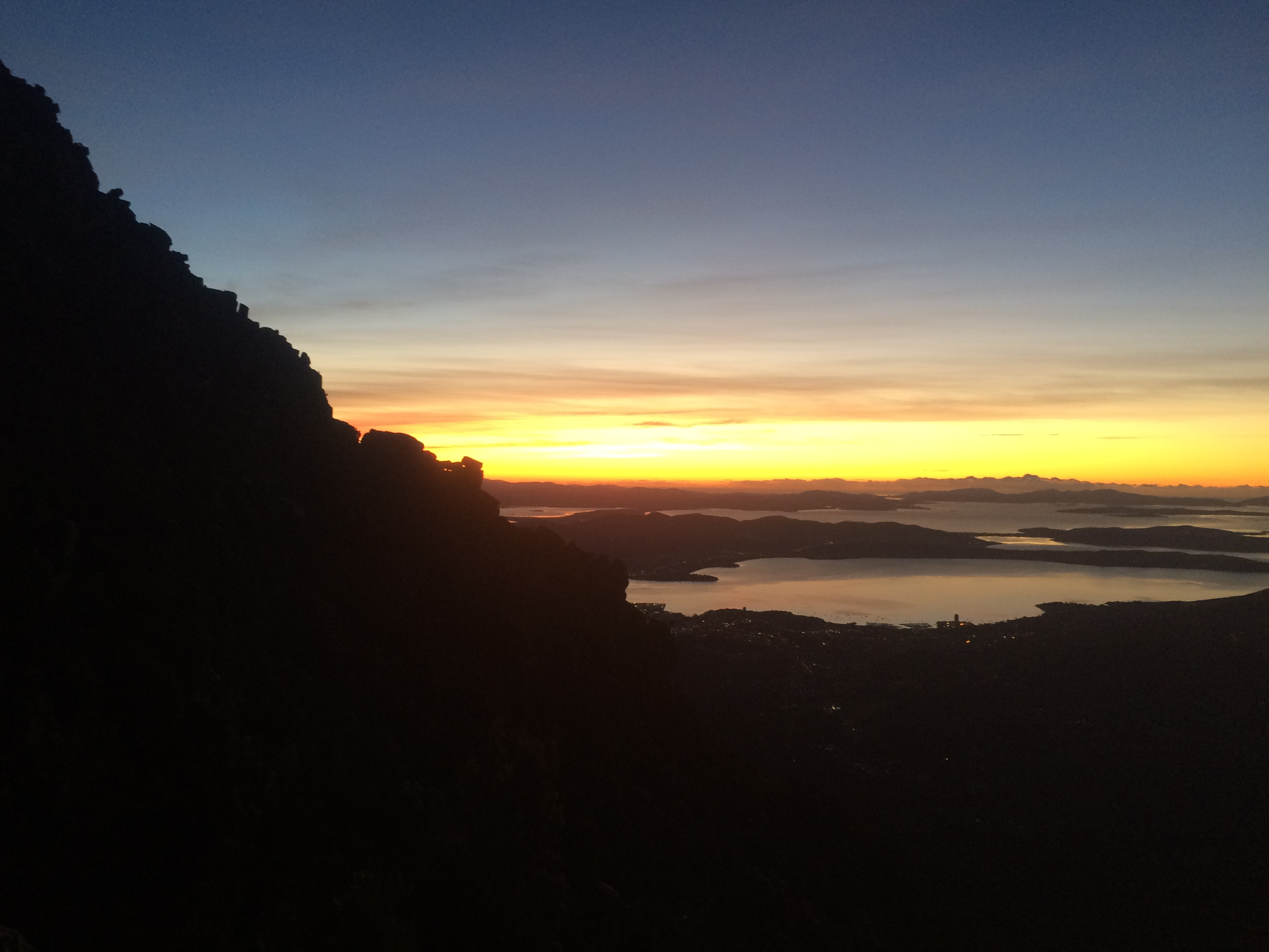
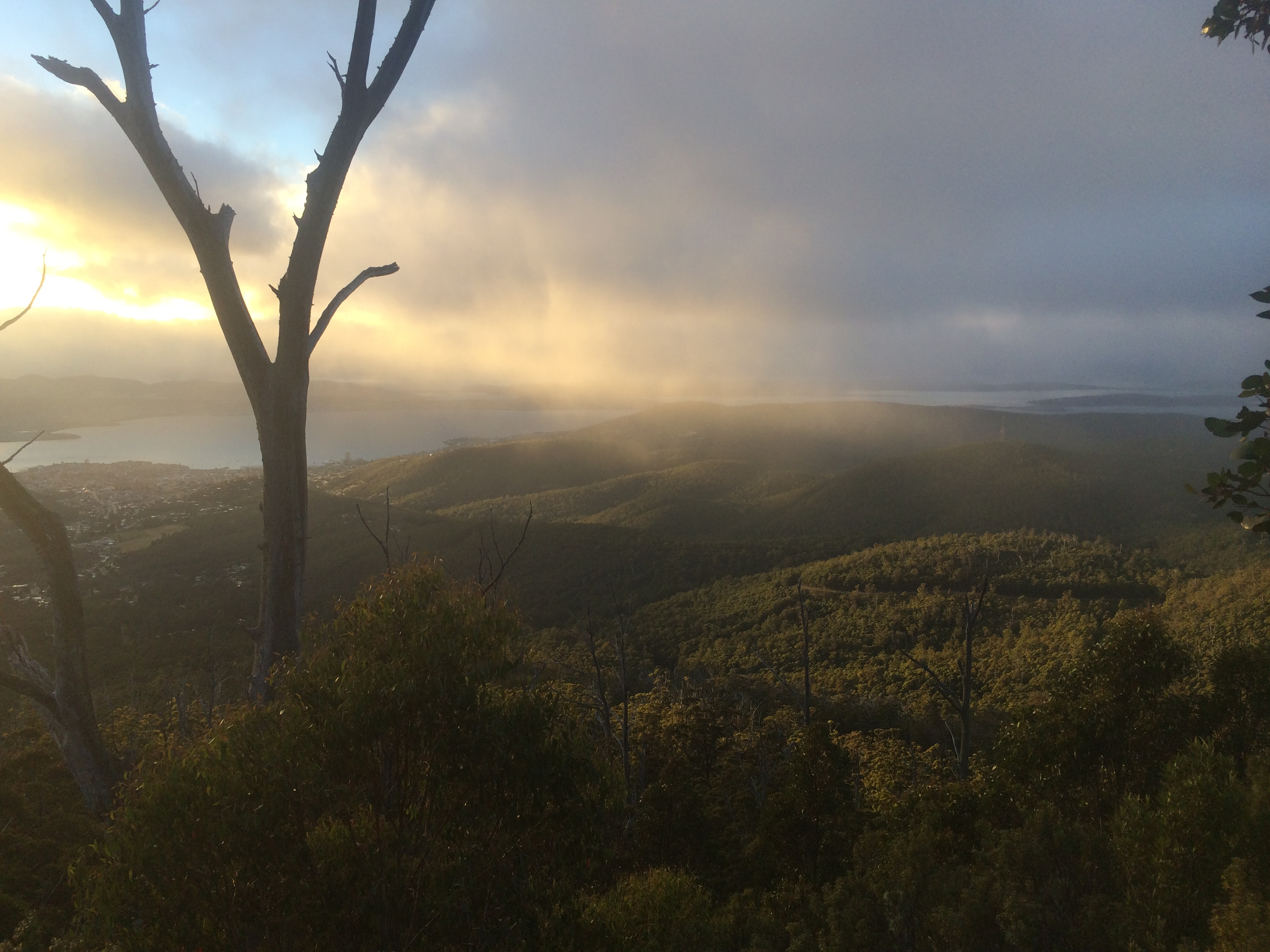
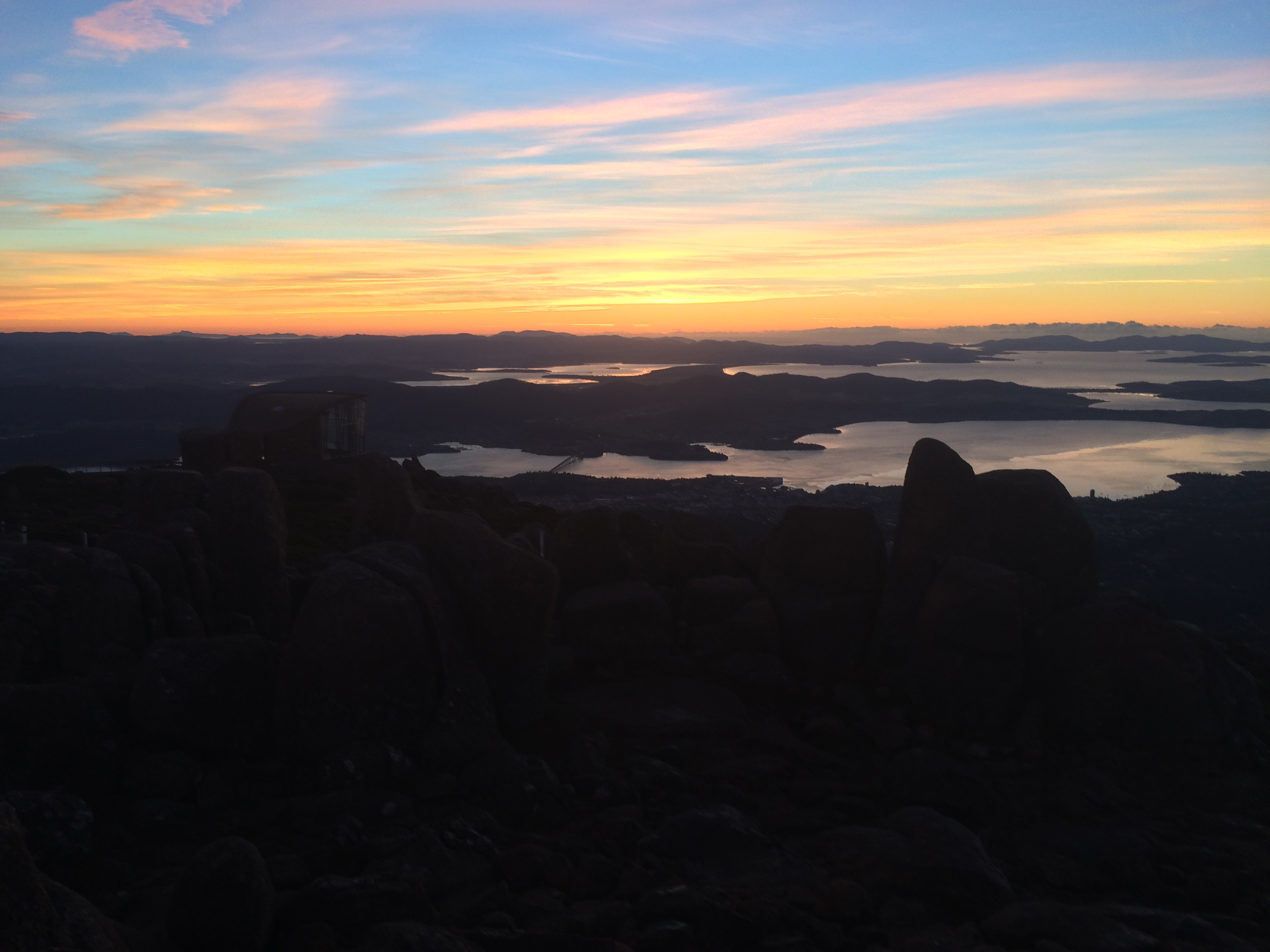
A walk with excellent views on a clear day, and atmospheric mist when cloudy, making your way through the sub alpine environment on this track is one of the highlights of Kunanyi’s expansive walking trail network.
Highlights
Epic views over Hobart and the surrounding areas, the dolerite columns of the Organ Pipes, ragged sub-alpine terrain, and the occasional Wedge-Tailed Eagle gliding in the wind.
Nature
Park size: 18,011 hectares
Natural features
Great views of the Organ Pipes, the dolarite cliffs at the face of Kunanyi, can be seen from the Zig-Zag track. The wind-swept, sub-alpine flora along the trail is also a highlight. Keep your eyes out for Wedge-tailed Eagles (Aquila audax fleayi) hovering off above.
Conservation
Kunanyi/Mt Wellington is a known breeding ground for the critically endangered Swift Parrot (Lathamus discolor) and is also home to the endangered Tasmanian Masked Owl (Tyto novaehollandiae castanops), Wedge-tailed Eagle (Aquila audax fleayi) and Tasmanian Devil (Sarcophilus harrisii).
Feral cats are a threat to biodiversity within the park, as are other Introduced species including the Superb Lyrebird (Menura novaehollandiae).
Track details
Starting from The Springs car park, cross the road near the café and toilets to the road opposite, Pinnacle Track Road, and follow it for a short distance before turning right on to the Radford Track. This will lead you up to the road again, where you will continue to your right for around 40 metres, to the start of the Pinnacle Track, which is signposted.
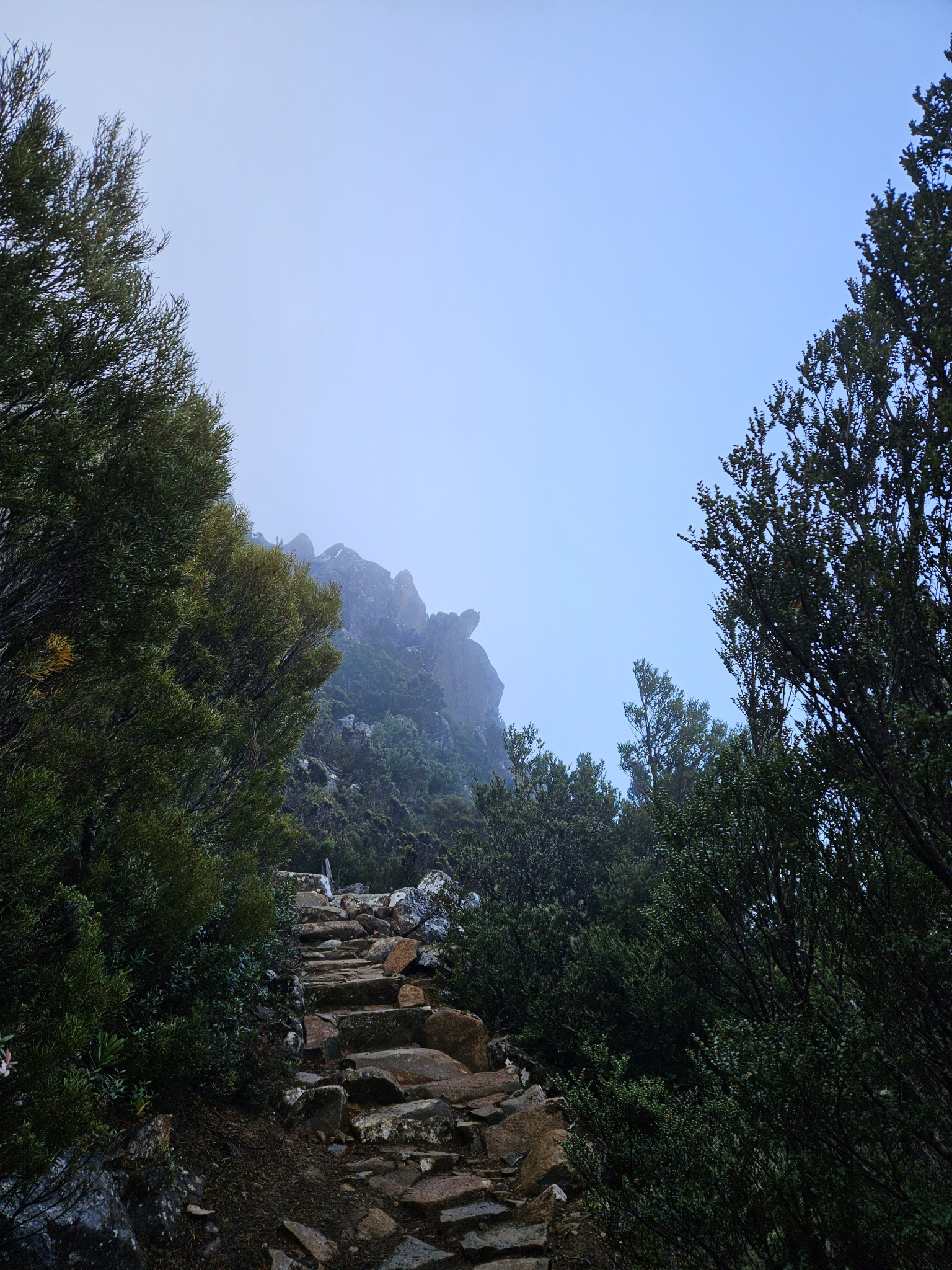
Follow the Pinnacle Track through the eucalyptus forest and sub-alpine flora for 1.5km where you will come across a signpost to the Zig-Zag track. Here, you will follow the sign and take a left-hand turn, leading up towards Kunanyi’s peak on the Zig-Zag Track for another 1.4km. The trail is well made, but steep, quickly gaining altitude. As you make your way up, the trail leaves the protection of the forest, becoming exposed to elements. This section has nearly constant views looking out over Hobart and its surrounding areas. If there is colder weather, the rock can become slippery, especially when frozen or snow covered, requiring additional care.
Once you have nearly reached the top, the track begins to flatten out, before finishing at the pinnacle carpark. Once you have finished exploring the top of Kunanyi, make your way back down the way you came.
Conditions
On colder days, the trail may be covered in Ice, making it very slippery.
Weather conditions within Wellington Park can change rapidly, potentially bringing high winds, rain, and snow, even in summer. Check local weather forecasts before attempting any walks in Wellington Park. Also be aware that roads may be closed on certain days during winter due to icy roads and snow cover.
Ensure you have appropriate sun protection, as UV radiation is stronger in high altitude areas, such as on mountains. The fire danger rating for the area should also be checked. Be aware that Wellington Park is closed on days with a fire danger rating of Extreme or Catastrophic in the Upper Derwent Valley or South East districts.
For up to date weather forecasting on Kunanyi/Mount Wellington, refer to: http://www.bom.gov.au/tas/forecasts/mtwellington.shtml
Safety advice
This trail is extremely exposed to the elements and should not be attempted during storms, blizzards or other adverse weather events.
Ensure you are appropriately prepared for mountain weather conditions, and have warm clothing, a waterproof jacket, sturdy walking boots, and food and water.
Weather conditions can change rapidly within the area, with freezing temperatures occurring regularly.
Hikers should also be aware of the possibility of bushfires as this is a forested environment.
During spring, summer and autumn, be aware that snakes may be active in the area. If encountered, move away from them slowly.
If you are injured and require emergency medical attention, call 000.
For further information on bushfires in Tasmania, refer to: https://www.fire.tas.gov.au/
Age restrictions and advice
This is a strenuous walk, and adult supervision of children is required. This walk is not recommended for very young children, and a decent level of fitness is recommended.
Location
Pinnacle Road, Wellington Park Tasmania 7054, Australia
From Hobart, drive up Davey Street, which later becomes Huon Road. Continue around 7.2km past the Southern Outlet intersection before turning on to Pillinger Drive, which then becomes Pinnacle Road. From the turnoff, continue up the road for 4.1km, where you will reach The Springs. Here, you will find multiple car parks, however, it can be busy during holidays.
Alternatively, the Kunanyi/Mt Wellington Explorer Bus can be used to Access The Springs as well as other parts of the mountain, with more information provided here: https://mtwellingtonexplorer.com.au/
Nature
Park size: 18,011 hectares
Natural features
Great views of the Organ Pipes, the dolarite cliffs at the face of Kunanyi, can be seen from the Zig-Zag track. The wind-swept, sub-alpine flora along the trail is also a highlight. Keep your eyes out for Wedge-tailed Eagles (Aquila audax fleayi) hovering off above.
Conservation
Kunanyi/Mt Wellington is a known breeding ground for the critically endangered Swift Parrot (Lathamus discolor) and is also home to the endangered Tasmanian Masked Owl (Tyto novaehollandiae castanops), Wedge-tailed Eagle (Aquila audax fleayi) and Tasmanian Devil (Sarcophilus harrisii).
Feral cats are a threat to biodiversity within the park, as are other Introduced species including the Superb Lyrebird (Menura novaehollandiae).
Track details
Starting from The Springs car park, cross the road near the café and toilets to the road opposite, Pinnacle Track Road, and follow it for a short distance before turning right on to the Radford Track. This will lead you up to the road again, where you will continue to your right for around 40 metres, to the start of the Pinnacle Track, which is signposted.
Follow the Pinnacle Track through the eucalyptus forest and sub-alpine flora for 1.5km where you will come across a signpost to the Zig-Zag track. Here, you will follow the sign and take a left-hand turn, leading up towards Kunanyi’s peak on the Zig-Zag Track for another 1.4km. The trail is well made, but steep, quickly gaining altitude. As you make your way up, the trail leaves the protection of the forest, becoming exposed to elements. This section has nearly constant views looking out over Hobart and its surrounding areas. If there is colder weather, the rock can become slippery, especially when frozen or snow covered, requiring additional care.
Once you have nearly reached the top, the track begins to flatten out, before finishing at the pinnacle carpark. Once you have finished exploring the top of Kunanyi, make your way back down the way you came.
Conditions
On colder days, the trail may be covered in Ice, making it very slippery.
Weather conditions within Wellington Park can change rapidly, potentially bringing high winds, rain, and snow, even in summer. Check local weather forecasts before attempting any walks in Wellington Park. Also be aware that roads may be closed on certain days during winter due to icy roads and snow cover.
Ensure you have appropriate sun protection, as UV radiation is stronger in high altitude areas, such as on mountains. The fire danger rating for the area should also be checked. Be aware that Wellington Park is closed on days with a fire danger rating of Extreme or Catastrophic in the Upper Derwent Valley or South East districts.
For up to date weather forecasting on Kunanyi/Mount Wellington, refer to: http://www.bom.gov.au/tas/forecasts/mtwellington.shtml
Safety advice
This trail is extremely exposed to the elements and should not be attempted during storms, blizzards or other adverse weather events.
Ensure you are appropriately prepared for mountain weather conditions, and have warm clothing, a waterproof jacket, sturdy walking boots, and food and water.
Weather conditions can change rapidly within the area, with freezing temperatures occurring regularly.
Hikers should also be aware of the possibility of bushfires as this is a forested environment.
During spring, summer and autumn, be aware that snakes may be active in the area. If encountered, move away from them slowly.
If you are injured and require emergency medical attention, call 000.
For further information on bushfires in Tasmania, refer to: https://www.fire.tas.gov.au/
Age restrictions and advice
This is a strenuous walk, and adult supervision of children is required. This walk is not recommended for very young children, and a decent level of fitness is recommended.
Location
Pinnacle Road, Wellington Park Tasmania 7054, Australia
From Hobart, drive up Davey Street, which later becomes Huon Road. Continue around 7.2km past the Southern Outlet intersection before turning on to Pillinger Drive, which then becomes Pinnacle Road. From the turnoff, continue up the road for 4.1km, where you will reach The Springs. Here, you will find multiple car parks, however, it can be busy during holidays.
Alternatively, the Kunanyi/Mt Wellington Explorer Bus can be used to Access The Springs as well as other parts of the mountain, with more information provided here: https://mtwellingtonexplorer.com.au/
Key info
90 minutes one way
3.16km one way
Grade 3: Difficult
Facilities
There are public toilets located at The Springs and The Pinnacle, and a lookout shelter at The Pinnacle. There is a café and public BBQ located at The Springs, however, there is no food available at The Pinnacle.