
A satisfying walk with plenty to see, including a waterfall, a lookout and stone cabin, as you make your way from the dry eucalyptus forests of Lenah Valley, up toward the cooler and more mountainous terrain of The Springs.
Highlights
Eucalyptus forests, a waterfall, expansive views from the lookout and plentiful bird life. Keep your eyes out for Yellow-tailed Black Cockatoos (Zanda funereal) and Wedge-tailed Eagles (Aquila audax fleayi).
Nature
Park size: 18,011 hectares
Natural features
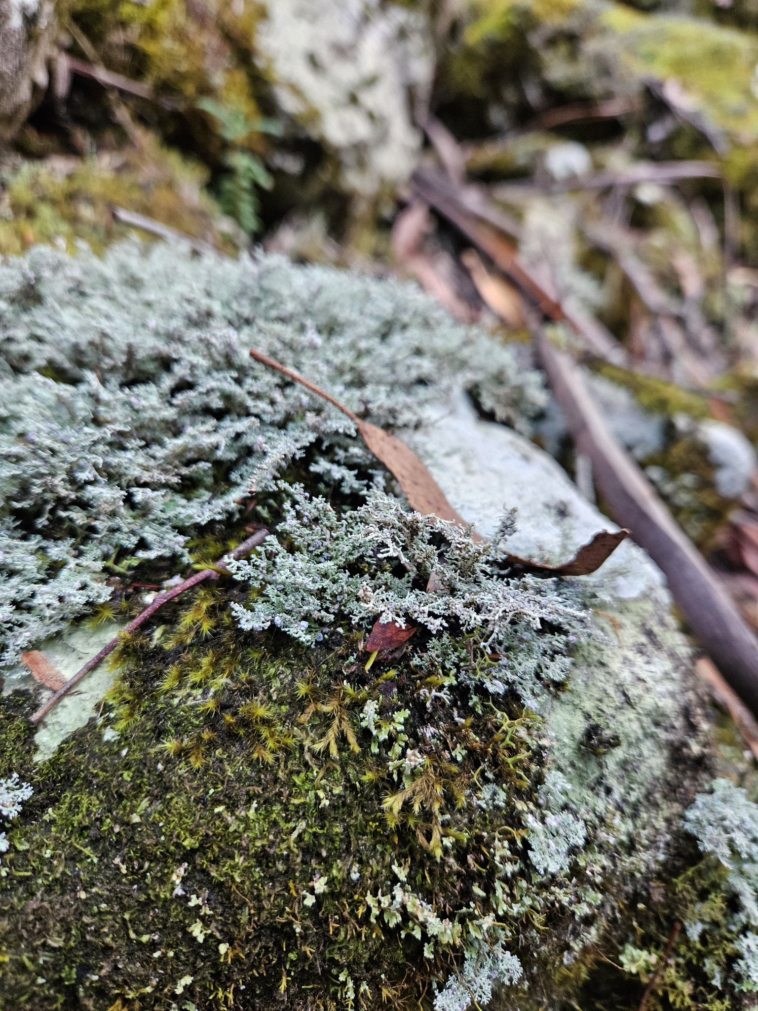
Eucalyptus forest, Yellow-tailed Black Cockatoos (Zanda funereal), Wedge-tailed Eagle (Aquila audax fleayi),moss and lichen-covered dolerite boulders, New Town Falls, Sphinx Rock and views of the Organ Pipes and Hobart and surrounds.
Conservation
Kunanyi/Mt Wellington is a known breeding ground for the critically endangered Swift Parrot (Lathamus discolor) and is also home to the endangered Tasmanian Masked Owl (Tyto novaehollandiae castanops), Wedge-tailed Eagle (Aquila audax fleayi) and Tasmanian Devil (Sarcophilus harrisii).
Feral cats are a threat to biodiversity within the park, as are other Introduced species including the Superb Lyrebird (Menura novaehollandiae).
Track details
Please keep in mind this is a one way trail, and unless you are walking in and out (total distance of 13.6km), a car shuttle is required. The walk can be started in either direction. These notes outline the walk as completed from Lenah Valley. If starting from The Springs, take the directions in reverse.
The first section of the walk follows the same route as the New town Falls Walk.
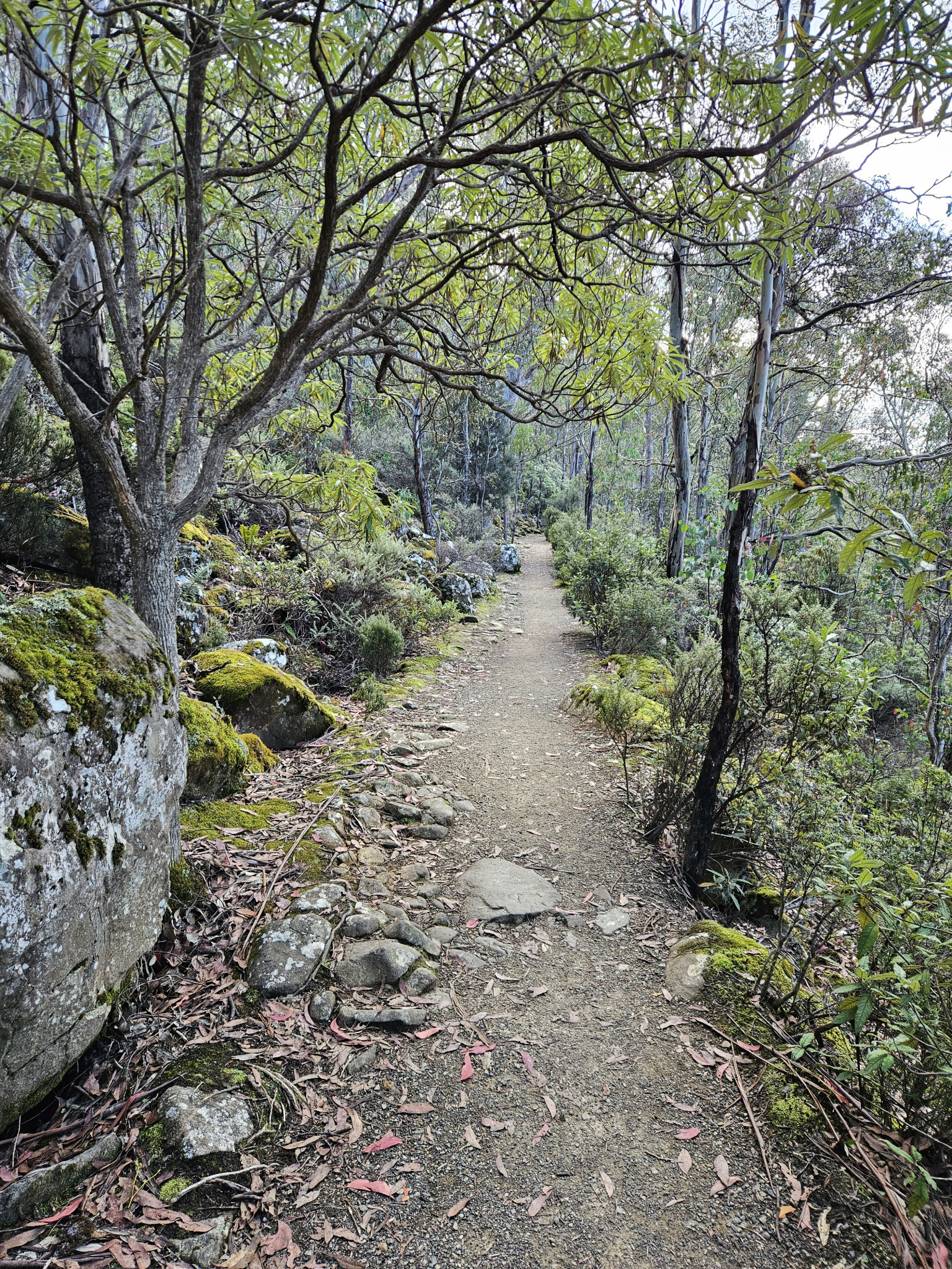
The trail starts at the end of Lenah Valley Road, where there is a concrete walkway across the New Town Rivulet. Cross the rivulet and pass a white gate. Continue walking for around 200 metres before coming to a Y intersection. Take the right trail which is the Lenah Valley Fire Trail. Follow the trail through the dry eucalyptus forest for around 550 metres, after which you will reach a signposted intersection.
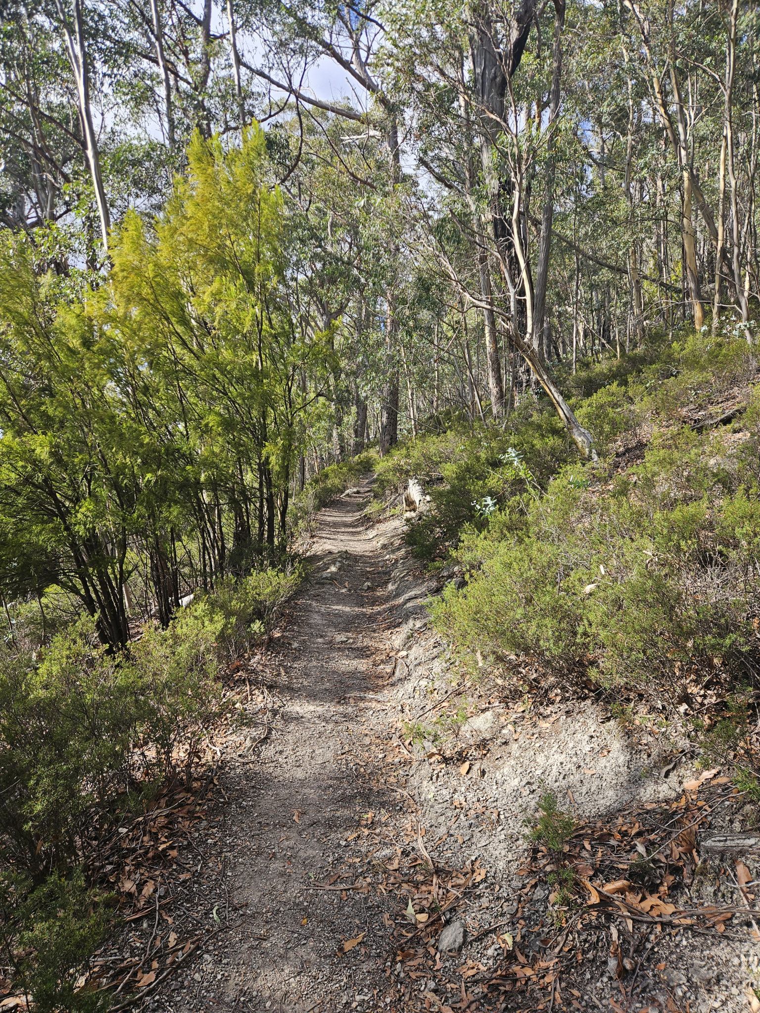
Here, you leave the fire trail behind and continue on to the Old Hobartians Track, which begins with a steep incline up stone steps with a handrail. The trail is quite steep in sections. This section of the trail traverses through denser forest, with the New Town Rivulet flowing at the bottom of the valley. After walking up hill for around 600 metres you will reach another signposted intersection. Here, there is the ruins of an old hut. To continue to New Town Falls and beyond, turn left on to the Lenah Valley Track. The forest throughout this section is more open, dry eucalyptus woodland, with large, dolerite boulders littered amongst the trees.
It is reasonably easy going for this next section, with the steepest parts of the trail behind you. After walking around 350 metres, a fire trail will cut across your path. Cross the fire trail and continue along your current track. After around 350 metres, you will come to a Y intersection. The left-hand, lower path leads to the lower viewing area of New Town Falls. Here, you can choose to follow the path to the lower viewing area before heading back to the main track, or alternatively, you can continue along the track you are currently on, which crosses the upper section of New Town Falls after around 150 metres.
None of the cliff edges here have railings, and the rock can be slippery, so approach with care. The stream that feeds the waterfall crosses the track and should not be crossed if it is flooding.
From here, continue along the trail towards Junction Cabin. After around 900 metres, you will reach a T intersection. Take the right-hand turn heading south, joining the Old Farm Road Fire Trail. After another 500 metres, you will reach another T intersection. Take the right hand turn that heads west, and after around 300 metres you will reach Junction Cabin.
This is a good spot for a snack break, and there is a picnic table located here. After having a rest and checking out the stone cabin, pay close attention to the signposts as there are several tracks that intersect here. The Lenah Valley Track is off to the left of the cabin, or southwest.
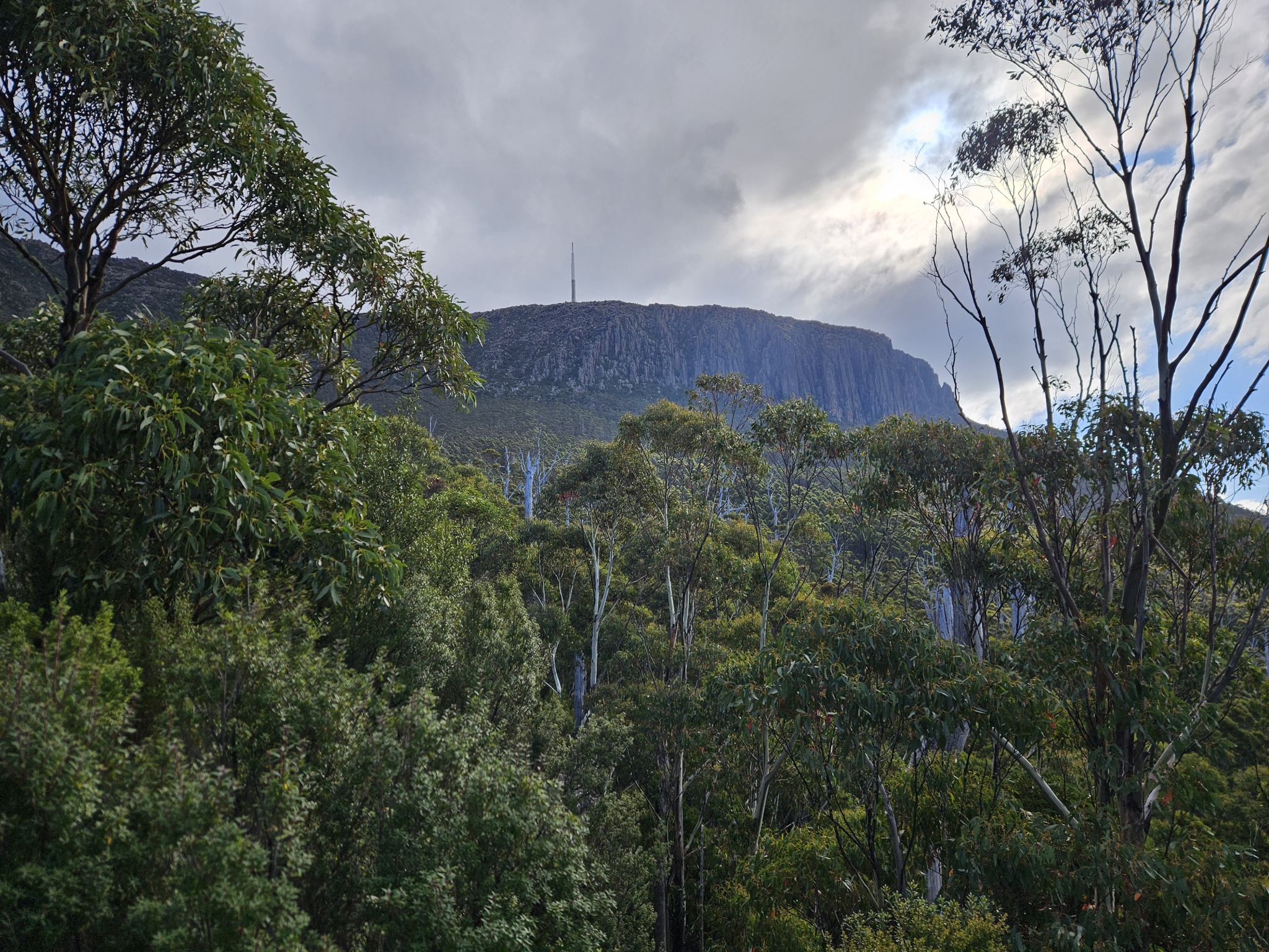
Continue to make your way along the track, and you will soon climb out of the heavily forested area into lighter, mountainous terrain, with lichen-covered dolerite boulder fields on either side. After walking 2.2km from Junction Cabin, ignoring the turnoffs along the way, you will come to the Sphinx Rock lookout turnoff. There will be signs warning you about the cliff edges at the lookout, and adult supervision of children here is a must.
After checking out the views from Sphinx Rock, continue on the track for another 1.3km and you will reach The Springs. This section is reasonably flat, easy walking.
At The Springs there are Public Toilets and a BBQ, as well as a café, and it is worth having a walk around, possibly checking out The Springs Lookout or another walk in the area. If you prepared a car shuttle, then this is where your walk will end, otherwise, once you are ready, make your way back the way you came.
Conditions
Weather conditions within Wellington Park can change rapidly, potentially bringing high winds, rain, and snow, even in summer. Check local weather forecasts before attempting any walks in Wellington Park. Also be aware that the road to The Springs may be closed on certain days during winter due to icy roads and snow cover.
Ensure you have appropriate sun protection, as UV radiation is stronger in high altitude areas, such as on mountains. The fire danger rating for the area should also be checked. Be aware that Wellington Park is closed on days with a fire danger rating of Extreme or Catastrophic in the Upper Derwent Valley or South East districts.
For up to date weather forecasting on Kunanyi/Mount Wellington, refer to: http://www.bom.gov.au/tas/forecasts/mtwellington.shtml
Safety advice
The cliff faces are not protected around the New Town Falls or Sphinx Rock, and the rock surfaces can be slippery when wet, so caution is required. Adult supervision is also recommended for these same reasons.
After heavy rain, New Town Falls may be flooded. The stream leading to the falls crosses The Lenah Valley Track and should not be crossed if there is fast-moving water.
Ensure you have map of the area and pay attention to which direction you are going at intersections, as it is easy to become lost on this trail.
Ensure you are appropriately prepared for mountain weather conditions, and have warm clothing, a waterproof jacket, sturdy walking shoes or boots, and enough food and water. Be aware that conditions can change rapidly in the area.
Hikers should also be aware of the possibility of bushfires as this is a forested environment.
During spring, summer and autumn, be aware that snakes may be active in the area. If encountered, move away from them slowly.
If you are injured and require emergency medical attention, call 000.
For further information on bushfires in Tasmania, refer to: https://www.fire.tas.gov.au/
Age restrictions and advice
There are steep sections and exposed cliff faces, requiring adult supervision of children. The walk may be too long for young children.
Location
387a Lenah Valley Road, Lenah Valley Tasmania 7008, Australia
Please keep in mind that this walk is one way, and unless you are walking in and out, a car shuttle is required. This walk can be completed in either direction.
If starting from Lenah Valley, from Hobart, drive north up Elizabeth Street for around 2km before turning on to Augusta Road. Follow Augusta Road until it becomes Lenah valley Road for 5.3km. This will bring you to the end of road, stopping where there is a small car park before it becomes private access only.
If starting from The Springs, from Hobart, drive up Davey Street, which later becomes Huon Road. Continue around 7.2km past the Southern Outlet intersection before turning on to Pillinger Drive, which then becomes Pinnacle Road. From the turnoff, continue up the road for 4.1km, where you will reach The Springs. Here, you will find multiple car parks, however, it can be busy during holidays.
Nature
Park size: 18,011 hectares
Natural features
Eucalyptus forest, Yellow-tailed Black Cockatoos (Zanda funereal), Wedge-tailed Eagle (Aquila audax fleayi),moss and lichen-covered dolerite boulders, New Town Falls, Sphinx Rock and views of the Organ Pipes and Hobart and surrounds.
Conservation
Kunanyi/Mt Wellington is a known breeding ground for the critically endangered Swift Parrot (Lathamus discolor) and is also home to the endangered Tasmanian Masked Owl (Tyto novaehollandiae castanops), Wedge-tailed Eagle (Aquila audax fleayi) and Tasmanian Devil (Sarcophilus harrisii).
Feral cats are a threat to biodiversity within the park, as are other Introduced species including the Superb Lyrebird (Menura novaehollandiae).
Track details
Please keep in mind this is a one way trail, and unless you are walking in and out (total distance of 13.6km), a car shuttle is required. The walk can be started in either direction. These notes outline the walk as completed from Lenah Valley. If starting from The Springs, take the directions in reverse.
The first section of the walk follows the same route as the New town Falls Walk.
The trail starts at the end of Lenah Valley Road, where there is a concrete walkway across the New Town Rivulet. Cross the rivulet and pass a white gate. Continue walking for around 200 metres before coming to a Y intersection. Take the right trail which is the Lenah Valley Fire Trail. Follow the trail through the dry eucalyptus forest for around 550 metres, after which you will reach a signposted intersection.
Here, you leave the fire trail behind and continue on to the Old Hobartians Track, which begins with a steep incline up stone steps with a handrail. The trail is quite steep in sections. This section of the trail traverses through denser forest, with the New Town Rivulet flowing at the bottom of the valley. After walking up hill for around 600 metres you will reach another signposted intersection. Here, there is the ruins of an old hut. To continue to New Town Falls and beyond, turn left on to the Lenah Valley Track. The forest throughout this section is more open, dry eucalyptus woodland, with large, dolerite boulders littered amongst the trees.
It is reasonably easy going for this next section, with the steepest parts of the trail behind you. After walking around 350 metres, a fire trail will cut across your path. Cross the fire trail and continue along your current track. After around 350 metres, you will come to a Y intersection. The left-hand, lower path leads to the lower viewing area of New Town Falls. Here, you can choose to follow the path to the lower viewing area before heading back to the main track, or alternatively, you can continue along the track you are currently on, which crosses the upper section of New Town Falls after around 150 metres.
None of the cliff edges here have railings, and the rock can be slippery, so approach with care. The stream that feeds the waterfall crosses the track and should not be crossed if it is flooding.
From here, continue along the trail towards Junction Cabin. After around 900 metres, you will reach a T intersection. Take the right-hand turn heading south, joining the Old Farm Road Fire Trail. After another 500 metres, you will reach another T intersection. Take the right hand turn that heads west, and after around 300 metres you will reach Junction Cabin.
This is a good spot for a snack break, and there is a picnic table located here. After having a rest and checking out the stone cabin, pay close attention to the signposts as there are several tracks that intersect here. The Lenah Valley Track is off to the left of the cabin, or southwest.
Continue to make your way along the track, and you will soon climb out of the heavily forested area into lighter, mountainous terrain, with lichen-covered dolerite boulder fields on either side. After walking 2.2km from Junction Cabin, ignoring the turnoffs along the way, you will come to the Sphinx Rock lookout turnoff. There will be signs warning you about the cliff edges at the lookout, and adult supervision of children here is a must.
After checking out the views from Sphinx Rock, continue on the track for another 1.3km and you will reach The Springs. This section is reasonably flat, easy walking.
At The Springs there are Public Toilets and a BBQ, as well as a café, and it is worth having a walk around, possibly checking out The Springs Lookout or another walk in the area. If you prepared a car shuttle, then this is where your walk will end, otherwise, once you are ready, make your way back the way you came.
Conditions
Weather conditions within Wellington Park can change rapidly, potentially bringing high winds, rain, and snow, even in summer. Check local weather forecasts before attempting any walks in Wellington Park. Also be aware that the road to The Springs may be closed on certain days during winter due to icy roads and snow cover.
Ensure you have appropriate sun protection, as UV radiation is stronger in high altitude areas, such as on mountains. The fire danger rating for the area should also be checked. Be aware that Wellington Park is closed on days with a fire danger rating of Extreme or Catastrophic in the Upper Derwent Valley or South East districts.
For up to date weather forecasting on Kunanyi/Mount Wellington, refer to: http://www.bom.gov.au/tas/forecasts/mtwellington.shtml
Safety advice
The cliff faces are not protected around the New Town Falls or Sphinx Rock, and the rock surfaces can be slippery when wet, so caution is required. Adult supervision is also recommended for these same reasons.
After heavy rain, New Town Falls may be flooded. The stream leading to the falls crosses The Lenah Valley Track and should not be crossed if there is fast-moving water.
Ensure you have map of the area and pay attention to which direction you are going at intersections, as it is easy to become lost on this trail.
Ensure you are appropriately prepared for mountain weather conditions, and have warm clothing, a waterproof jacket, sturdy walking shoes or boots, and enough food and water. Be aware that conditions can change rapidly in the area.
Hikers should also be aware of the possibility of bushfires as this is a forested environment.
During spring, summer and autumn, be aware that snakes may be active in the area. If encountered, move away from them slowly.
If you are injured and require emergency medical attention, call 000.
For further information on bushfires in Tasmania, refer to: https://www.fire.tas.gov.au/
Age restrictions and advice
There are steep sections and exposed cliff faces, requiring adult supervision of children. The walk may be too long for young children.
Location
387a Lenah Valley Road, Lenah Valley Tasmania 7008, Australia
Please keep in mind that this walk is one way, and unless you are walking in and out, a car shuttle is required. This walk can be completed in either direction.
If starting from Lenah Valley, from Hobart, drive north up Elizabeth Street for around 2km before turning on to Augusta Road. Follow Augusta Road until it becomes Lenah valley Road for 5.3km. This will bring you to the end of road, stopping where there is a small car park before it becomes private access only.
If starting from The Springs, from Hobart, drive up Davey Street, which later becomes Huon Road. Continue around 7.2km past the Southern Outlet intersection before turning on to Pillinger Drive, which then becomes Pinnacle Road. From the turnoff, continue up the road for 4.1km, where you will reach The Springs. Here, you will find multiple car parks, however, it can be busy during holidays.
Key info
2 hours 40 minutes plus breaks one way
6.8km one way
Grade 3: Difficult
Facilities
Please keep in mind that all facilities are at The Springs, and there are no other facilities along the way.
If bringing your dog along, please keep it on a leash and on the trail, as this is habitat for native species, and is also a courtesy to other track users.