
A steep but rewarding walk with exceptional views in the remote, southerly section of Wellington Park.
Highlights
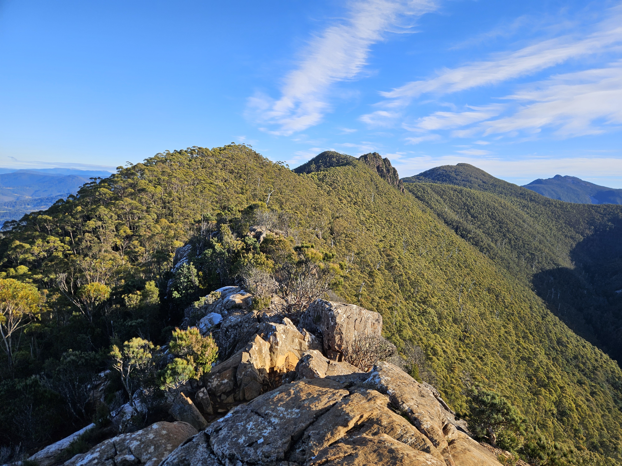
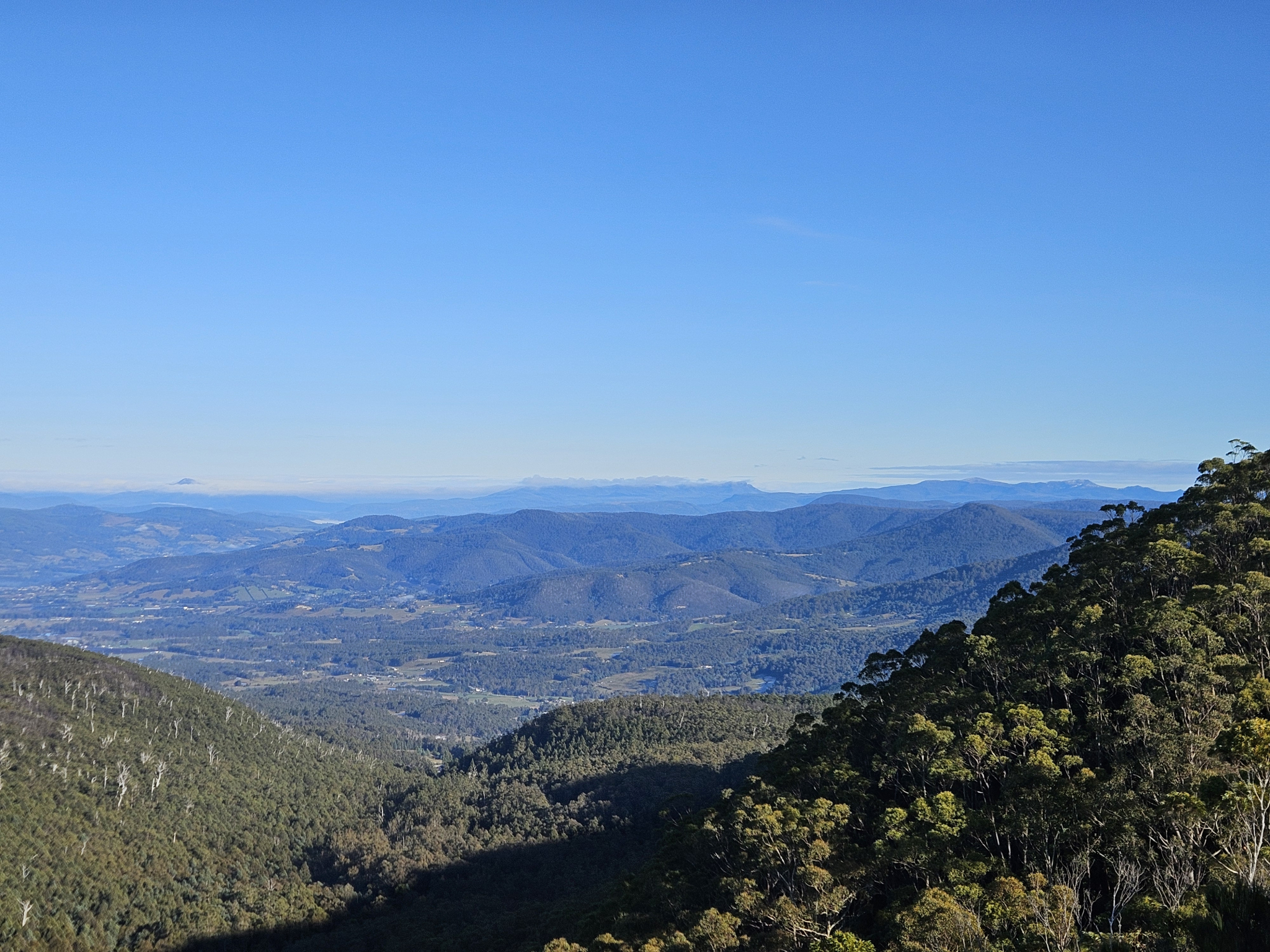
Epic views from Cathedral Rock over the Wellington Range, Bruny Island, Storm Bay, the Huon Valley and the Montagu Thumbs, the peaceful North West Bay River, and plentiful bird life along the way.
Nature
Park size: 18,011 hectares
Natural features
Varying flora including Tasmanian Tree Ferns (Dicksonia antarctica), as well as several species of dogwood, acacia, and eucalyptus. a wide range of bird life can also be seen or heard, including Green Rosellas (Platycercus caledonicus), Yellow-Tailed Black Cockatoos (Zanda funerea), the Wedge-tailed Eagle (Aquila audax fleayi) and the Superb Lyrebird (Menura novaehollandiae).
Conservation
Kunanyi/Mt Wellington is a known breeding ground for the critically endangered Swift Parrot (Lathamus discolor) and is also home to the endangered Tasmanian Masked Owl (Tyto novaehollandiae castanops), Wedge-tailed Eagle (Aquila audax fleayi) and Tasmanian Devil (Sarcophilus harrisii).
Feral cats are a threat to biodiversity within the park, as are other Introduced species including the Superb Lyrebird (Menura novaehollandiae).
Track details
Start walking from the car park next to North West Bay River up the hill along the road. There are several private properties that have driveways connecting to the road at this point, and walkers should ensure they remain on the main road. After around 480 metres, a separate track splits off to the right, which is the beginning of the Cathedral Rock Track. Take this turnoff.
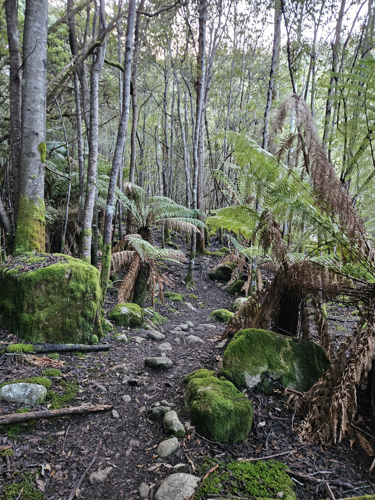
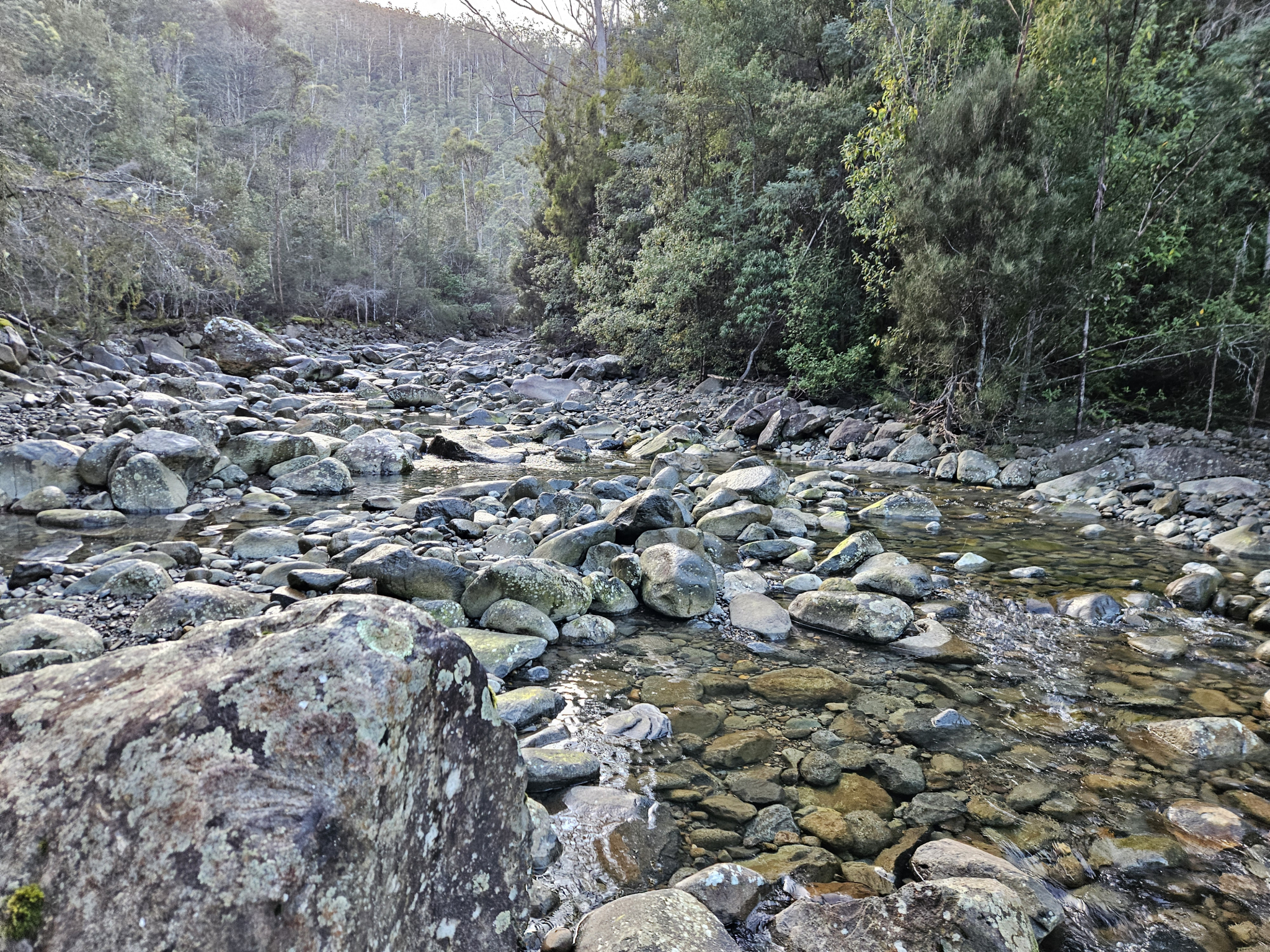
The first few kilometres of the trail follows the river, with mossy boulders and ferns lining the track. After walking for around 1.6km, the trail begins to get gradually steeper, before levelling out again. Some sections along here can become quite muddy. This area is rich with bird life, including the Superb Lyrebird (Menura novaehollandiae), and it is worth keeping an ear out for them as they mimic multiple other bird species calls.
Around 2.8km into the walk, you will reach the main uphill section that leads up to Cathedral Rock. This section of the walk is very steep, gaining hundreds of metres of altitude over a relatively short distance.
As you gain altitude, the forest and flora around you goes through multiple changes, morphing from wet sclerophyll dominated by acacia and dogwood in to wet eucalyptus forest, with sub alpine species beginning to make an appearance.
Once you have been walking for around 3.9kms, you will reach a track intersection for the Betts Hill and Cathedral Rock Tracks. Take the right hand turn to stay on the Cathedral Rock Track for the push to the summit. The last few hundred metres to the top of Cathedral Rock are very steep and some rock scrambling is required. Look out for frost or ice on the rock, as it is south facing and will often have some on it during the colder months.
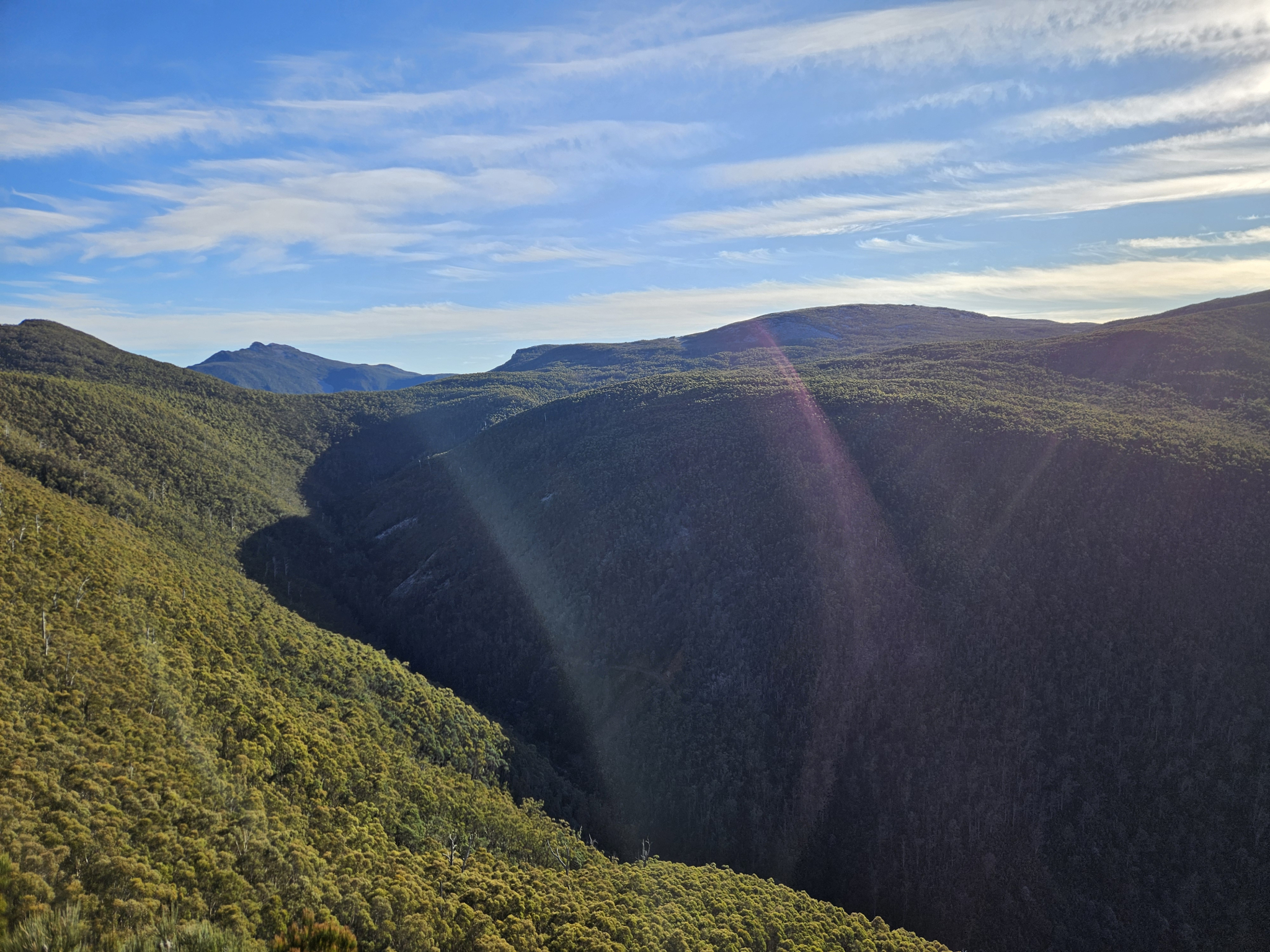
Once you are at the top of Cathedral Rock, there are several lookout points with excellent views out to Storm Bay, the Wellington Range and the D’Entrecasteaux Channel. Perhaps the most impressive viewpoint is out across the Montagu Thumbs, the ridgeline behind Cathedral Rock.
There is, however, quite a sharp and sudden drop-off, especially on the northern face, and extra care should be taken while exploring this area, staying away from the cliffs edge.
Once you have taken the time to enjoy the summit of Cathedral Rock, begin to make your way back the way you came. Ensure caution is taken heading downhill from the summit over the sections that require rock scrambling, especially in damp or slippery conditions.
Continue back along the same trail you took to get to the summit. On a hot day, there are rock pools along North West Bay River that can be an excellent spot to cool off before making your way back to the car park and the end of your walk.
Conditions
The upper section of this walk is extremely exposed to the weather, with strong winds, freezing temperatures, snow and rain occurring regularly.
While conditions may be fine at the outset of your walk, weather conditions within in this section of the park can change rapidly, potentially bringing high winds, rain, and snow, even during summer, and caution should be taken when attepting to summit Cathedral Rock.
Check local weather forecasts before attempting any walks in Wellington Park.
Ensure you have appropriate sun protection, as UV radiation is stronger in high altitude areas, such as on mountains. The fire danger rating for the area should also be checked. Be aware that Wellington Park is closed on days with a fire danger rating of Extreme or Catastrophic in the Upper Derwent Valley or Southeast districts.
For up to date weather forecasting on Kunanyi/Mount Wellington, refer to: http://www.bom.gov.au/tas/forecasts/mtwellington.shtml
Safety advice
The pinnacle of Cathedral Rock is very exposed to shear drops of hundreds of metres, requiring extra care from walkers.
Weather conditions change rapidly in the area, and freezing temperatures occurring regularly.
Ensure you are appropriately prepared for mountain weather conditions, and have warm clothing, a waterproof jacket, sturdy walking boots, food and water. Attempting walks in this region without adequate preparation is extremely dangerous and may lead to hypothermia and death.
Ensure you let at least two people know which hike you are completing in case of an emergency.
This trail is steep, with the majority of the walk going up or down hill, so walking poles are advised to protect your knees.
Hikers should also be aware of the possibility of bushfires as this is a forested environment.
During spring, summer and autumn, be aware that snakes may be active in the area. If encountered, move away from them slowly.
If you are injured and require emergency medical attention, call 000.
For further information on bushfires in Tasmania, refer to: https://www.fire.tas.gov.au/
Age restrictions and advice
This walk is not recommended for very young children. Any children on this walk should be supervised at all times. There are sudden dropoffs and unfenced cliff ledges on Cathedral Rock, and children may become lost if walking seperate to the group.
Location
107 Betts Road, Neika Tasmania 7054, Australia
From Hobart, head southwest, driving up Davey Street before turning left onto the Southern Outlet (A6). Follow the Southern Outlet for 9.4km, where you will need to be in the left lane that leads to Kingston and Huonville. Shortly after, you will come to a roundabout where you will take the third exit on to the Huon Highway (A6). From this point, continue for another 6.1km before turning right onto Leslie Road. Continue along Leslie Road for 3km, before turning right onto Huon Road, and then left onto Betts Road after 100 metres. Follow Betts Road for 1.2km. After crossing the bridge over the Northwest Bay River, you will come to the small car park for the Cathedral Rock track, which is where you will start your walk.
While the road continues for a short distance, it soon becomes private property, and you should not park your car past this point.
Nature
Park size: 18,011 hectares
Natural features
Varying flora including Tasmanian Tree Ferns (Dicksonia antarctica), as well as several species of dogwood, acacia, and eucalyptus. a wide range of bird life can also be seen or heard, including Green Rosellas (Platycercus caledonicus), Yellow-Tailed Black Cockatoos (Zanda funerea), the Wedge-tailed Eagle (Aquila audax fleayi) and the Superb Lyrebird (Menura novaehollandiae).
Conservation
Kunanyi/Mt Wellington is a known breeding ground for the critically endangered Swift Parrot (Lathamus discolor) and is also home to the endangered Tasmanian Masked Owl (Tyto novaehollandiae castanops), Wedge-tailed Eagle (Aquila audax fleayi) and Tasmanian Devil (Sarcophilus harrisii).
Feral cats are a threat to biodiversity within the park, as are other Introduced species including the Superb Lyrebird (Menura novaehollandiae).
Track details
Start walking from the car park next to North West Bay River up the hill along the road. There are several private properties that have driveways connecting to the road at this point, and walkers should ensure they remain on the main road. After around 480 metres, a separate track splits off to the right, which is the beginning of the Cathedral Rock Track. Take this turnoff.
The first few kilometres of the trail follows the river, with mossy boulders and ferns lining the track. After walking for around 1.6km, the trail begins to get gradually steeper, before levelling out again. Some sections along here can become quite muddy. This area is rich with bird life, including the Superb Lyrebird (Menura novaehollandiae), and it is worth keeping an ear out for them as they mimic multiple other bird species calls.
Around 2.8km into the walk, you will reach the main uphill section that leads up to Cathedral Rock. This section of the walk is very steep, gaining hundreds of metres of altitude over a relatively short distance.
As you gain altitude, the forest and flora around you goes through multiple changes, morphing from wet sclerophyll dominated by acacia and dogwood in to wet eucalyptus forest, with sub alpine species beginning to make an appearance.
Once you have been walking for around 3.9kms, you will reach a track intersection for the Betts Hill and Cathedral Rock Tracks. Take the right hand turn to stay on the Cathedral Rock Track for the push to the summit. The last few hundred metres to the top of Cathedral Rock are very steep and some rock scrambling is required. Look out for frost or ice on the rock, as it is south facing and will often have some on it during the colder months.
Once you are at the top of Cathedral Rock, there are several lookout points with excellent views out to Storm Bay, the Wellington Range and the D’Entrecasteaux Channel. Perhaps the most impressive viewpoint is out across the Montagu Thumbs, the ridgeline behind Cathedral Rock.
There is, however, quite a sharp and sudden drop-off, especially on the northern face, and extra care should be taken while exploring this area, staying away from the cliffs edge.
Once you have taken the time to enjoy the summit of Cathedral Rock, begin to make your way back the way you came. Ensure caution is taken heading downhill from the summit over the sections that require rock scrambling, especially in damp or slippery conditions.
Continue back along the same trail you took to get to the summit. On a hot day, there are rock pools along North West Bay River that can be an excellent spot to cool off before making your way back to the car park and the end of your walk.
Conditions
The upper section of this walk is extremely exposed to the weather, with strong winds, freezing temperatures, snow and rain occurring regularly.
While conditions may be fine at the outset of your walk, weather conditions within in this section of the park can change rapidly, potentially bringing high winds, rain, and snow, even during summer, and caution should be taken when attepting to summit Cathedral Rock.
Check local weather forecasts before attempting any walks in Wellington Park.
Ensure you have appropriate sun protection, as UV radiation is stronger in high altitude areas, such as on mountains. The fire danger rating for the area should also be checked. Be aware that Wellington Park is closed on days with a fire danger rating of Extreme or Catastrophic in the Upper Derwent Valley or Southeast districts.
For up to date weather forecasting on Kunanyi/Mount Wellington, refer to: http://www.bom.gov.au/tas/forecasts/mtwellington.shtml
Safety advice
The pinnacle of Cathedral Rock is very exposed to shear drops of hundreds of metres, requiring extra care from walkers.
Weather conditions change rapidly in the area, and freezing temperatures occurring regularly.
Ensure you are appropriately prepared for mountain weather conditions, and have warm clothing, a waterproof jacket, sturdy walking boots, food and water. Attempting walks in this region without adequate preparation is extremely dangerous and may lead to hypothermia and death.
Ensure you let at least two people know which hike you are completing in case of an emergency.
This trail is steep, with the majority of the walk going up or down hill, so walking poles are advised to protect your knees.
Hikers should also be aware of the possibility of bushfires as this is a forested environment.
During spring, summer and autumn, be aware that snakes may be active in the area. If encountered, move away from them slowly.
If you are injured and require emergency medical attention, call 000.
For further information on bushfires in Tasmania, refer to: https://www.fire.tas.gov.au/
Age restrictions and advice
This walk is not recommended for very young children. Any children on this walk should be supervised at all times. There are sudden dropoffs and unfenced cliff ledges on Cathedral Rock, and children may become lost if walking seperate to the group.
Location
107 Betts Road, Neika Tasmania 7054, Australia
From Hobart, head southwest, driving up Davey Street before turning left onto the Southern Outlet (A6). Follow the Southern Outlet for 9.4km, where you will need to be in the left lane that leads to Kingston and Huonville. Shortly after, you will come to a roundabout where you will take the third exit on to the Huon Highway (A6). From this point, continue for another 6.1km before turning right onto Leslie Road. Continue along Leslie Road for 3km, before turning right onto Huon Road, and then left onto Betts Road after 100 metres. Follow Betts Road for 1.2km. After crossing the bridge over the Northwest Bay River, you will come to the small car park for the Cathedral Rock track, which is where you will start your walk.
While the road continues for a short distance, it soon becomes private property, and you should not park your car past this point.