
Trekking to the Polish Base Camp of Nanga Parbat, Astore Valley, Gilgit-Baltistan, Pakistan
Chitral & Gilgit-Baltistan
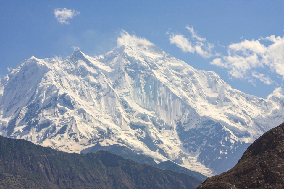
Nanga Parbat, at 8,126 metres, is the ninth highest mountain in the world. One of its most scenic approaches is through Rupal Valley in Astore District, Gilgit-Baltistan.
The trek starts in Tarishing village and leads toward the mountain's southern side, known as the Rupal Face. This huge mountain wall rises sharply above the valley and is one of Nanga Parbat's most striking features.
From Tarishing, the base camp is about 13 kilometres one way. The full return trek is therefore around 26 kilometres.

The route passes through Rupal village and then continues into the upper valley. Along the way, trekkers cross fields, pastures, streams and open mountain terrain.
Views of Nanga Parbat become clearer as the trail moves closer to the base camp.

The destination is commonly known as the Polish Base Camp because of its link with Polish mountaineers.
A major expedition from the Kraków Mountaineering Club established its base here on 26 May 1985, at an altitude of about 3,650 metres. During the same expedition, Jerzy Kukuczka, Carlos Carsolio, Andrzej Heinrich and Sławomir Łobodziński reached the summit of Nanga Parbat.
Polish climbers later used the area again, and the name Polish Base Camp remained associated with the site.

The name Rupal Face comes from Rupal Valley.
It is the southern side of Nanga Parbat and should not be confused with the incorrect term “Rural Face.”
Nanga Parbat can also be approached from other sides. Fairy Meadows, on the Rakhiot side, is the best known tourist route and offers a wide view of the mountain. The Diamir side is another important approach used by climbers.

The Rupal route is quieter and less crowded. It also brings trekkers much closer to the great southern wall of Nanga Parbat.
The trek to the Polish Base Camp is therefore not only a mountain walk.
It also offers a close look at the landscape, villages and climbing history of one of Pakistan’s most famous peaks.


Shams Uddin
Nanga Parbat, at 8,126 metres, is the ninth highest mountain in the world. One of its most scenic approaches is through Rupal Valley in Astore District, Gilgit-Baltistan.
The trek starts in Tarishing village and leads toward the mountain's southern side, known as the Rupal Face. This huge mountain wall rises sharply above the valley and is one of Nanga Parbat's most striking features.
From Tarishing, the base camp is about 13 kilometres one way. The full return trek is therefore around 26 kilometres.
The route passes through Rupal village and then continues into the upper valley. Along the way, trekkers cross fields, pastures, streams and open mountain terrain.
Views of Nanga Parbat become clearer as the trail moves closer to the base camp.
The destination is commonly known as the Polish Base Camp because of its link with Polish mountaineers.
A major expedition from the Kraków Mountaineering Club established its base here on 26 May 1985, at an altitude of about 3,650 metres. During the same expedition, Jerzy Kukuczka, Carlos Carsolio, Andrzej Heinrich and Sławomir Łobodziński reached the summit of Nanga Parbat.
Polish climbers later used the area again, and the name Polish Base Camp remained associated with the site.
The name Rupal Face comes from Rupal Valley.
It is the southern side of Nanga Parbat and should not be confused with the incorrect term “Rural Face.”
Nanga Parbat can also be approached from other sides. Fairy Meadows, on the Rakhiot side, is the best known tourist route and offers a wide view of the mountain. The Diamir side is another important approach used by climbers.
The Rupal route is quieter and less crowded. It also brings trekkers much closer to the great southern wall of Nanga Parbat.
The trek to the Polish Base Camp is therefore not only a mountain walk.
It also offers a close look at the landscape, villages and climbing history of one of Pakistan’s most famous peaks.
You might like...
When Spring Comes to the Mountains
A Journey into the Heart of the Karakoram, Northern Pakistan
The Glaciers of Rakaposhi
Why Rakaposhi Base Camp?
Newsletter
Sign up to keep in touch with articles, updates, events or news from Kuno, your platform for nature